Rather than pretend I am keeping up the blog by back dating entries, this post is a roll-up of things since Ketchikan.
There is a wonderful movie about birds, Winged Migration. I feel as though we’ve become a part of a human equivalent by joining the flocks of boats heading south for the winter. Boats that we’ve seen elsewhere in Alaska, for example Glacier Bay, Juneau or Sitka, cross paths with us along the main boat migratory paths.
 After saying goodbye to the guests, Mac & Wade, who have been travelling with the Nagles, we sit out several wet days, in Ketchikan waiting for suitable weather to cross Dixon Entrance and enter Canada.
We depart near noon on September 3, south for Canada. The Nagles pick up a couple hundred gallons of diesel on the way out and we motor at a slower speed so that they can catch up. The night is spent at Judd Harbor on the SE corner of Duke Island just north of Dixon.
 The anchorage proved to be like so many of the unexpected treasures on our trip. It was well protected and scenic. We even saw and heard some migrating Sandhill cranes before we left the next morning. We only wished we had more time to spend exploring and enjoying it further.
 The crossing of Dixon on September 4, was not a big issue. We deployed our weather side stabilizer fish to make the trip more comfortable in the swell coming off the ocean. Once we got in the shelter of Dundas Island, the seas laid nicely and we pulled in the stabilizer to reduce the drag. We saw lots of feeding humpback whales including some bubble feeding activity.
We were able to get dock space at the Prince Rupert Yacht Club, which had been filled on the way north. While on the dock, we met a Seattle couple completing a four year trip around the world on their sail boat, S/V Marcy. They did the circumnavigation the hard way by going around the Cape of Good Hope and Cape Horn. They sailed from the coast of Chile (Puerto Montt) to Hawaii and then from Hawaii to Alaska. What an adventure they have had!
From Prince Rupert we took the “outside-inside” route which avoided the long channels of Grenville and Princess Royal but stayed inside the protection of some large islands. We saw only a few fishing boats and one cruise ship for nearly three days.
 The first night, September 5, was at Newcombe Harbour, a deep, nearly land locked bay with good anchoring depths and holding.
 The second night, September 6, was in Dunn Passage on Campania Island. It had a narrow entrance and was a delightful collection of little islands. While we got a good anchor set, DavidEllis was struggling finding a good hook. They ended up rafting with us for the night. The winds were calm all night and our boats would just flip direction depending on the tide but hardly moved position.
The next day, September 7, we continued down Laredo Channel until we got to Meyers Passage, a convenient route back over to the main southbound route. We were an hour past slack water when we reached it but the currents were not running so strong as to make it impassable for our slow boats. We anchored in Clothes Bay, a mile or so south of the village of Klemtu.
September 8 was the short (36 mile) cruise to Shearwater. The Nagles were meeting a friend David Cohn flying in from Vancouver to the nearby community of Bella Bella. This Spring, David put his order in with Seahorse for a Diesel Duck like the Nagles. This time on the boat was his opportunity to see how the boat handled and learn from the Nagles about the care and feeding of a “duck.”
The next day, September 9, we continued our southbound trip and stopped at Pruth Harbor. Both the Nagles and we stopped here northbound and found the beach (Hakai beaches) across the island from the anchorage to be stunning.
An early start of 7AM (it is Autumn and that is when the sun rises now) and a long day on September 10 got us across Cape Caution and into Port Hardy, the major community at the north end of Vancouver Island. We stayed at the public docks near the Coast Guard station.
Trying to get some miles in before the forecasted winds picked up, on September 11, we traveled the short distance (25 miles or so) further down to Port McNeill. We first tried the docks at Sointula, across from Port McNeill but they were filled. Rather than staying at the city docks which can be tight, we stayed at the recently added docks attached to the fuel dock. Their orientation was perfect for docking in the 15 to 25 knot gusts that were now blowing. Lunch was at our favorite Port McNeill restaurant, Gus’s Pub. Marcia got here cajun shrimp with sweet potato fries.
 Back on the road again the next day, September 12, we stayed at the public dock at Port Neville. The DavidEllis docked first and we rafted to them. It is easier for their dog Rusty to get on and off the dock directly from the boat than having to get him over a boat rafted in between.
 Port Neville is one of those villages that was instrumental in the development of the area but has now become obsolete because of technology and further development. The general store and postal office is now, in effect, a museum.
Since we have cruised this section more that the Nagles, they let us set the route back down to the San Juans. From here, on September 13, we continued down Johnstone Straits. On account of adverse currents (wrong time of the month to head south), we were going less than 5 knots much of the time. Before we got to Seymour Narrows, we cut off along Okisollo Channel through Upper Rapids into the Octopus Islands Marine Park. This was our first anchorage on the northbound trip where we felt like we were really away from civilization (Octopus Island Marine Park). We took the kayaks down and paddled around the coves.
 The next day, September 14, was through Hole-in-the-Wall channel at slack and then down Calm and Lewis Channel into Desolation Sound. We anchored in Prideaux Haven. We are now encountering lots and lots of boats, probably a 15 to 20 in this anchorage. Some going south like us but many boats doing their September cruise into Desolation Sound. Besides the boats, the air temperature and water temperature are several degrees warmer than north of Cape Caution.
An early start on September 15 gets us down Malaspina Strait and past Texada Island to Smuggler Cove Marine Park. We stayed here in 2007 on our previous boat Dragontail (MV Dragontail blog). The anchorage is tight so the BC Parks has put in rings on the shore to which you tie your stern after dropping your anchor. The idea is to eliminate all of the boats swinging and to pack in lots more boats.
We haven’t done a huge number of stern ties and none on Alpenglow. After three anchor drops we find a good spot and hook. We drop a kayak and Kurt paddles to shore with a lap full of line. He passes the line through the ring and pulls himself back to the boat while continuing to trail out line. We then cleat off the bitter end on the boat and start pulling in slack on the spool side. Eventually we get the boat turned around so that the stern is pulled tight towards the anchor ring on shore. I am sure with practice we can smooth out the process.
September 16 was the crossing of the Strait of Georgia into the BC Gulf Islands. The Gulf Islands and the Washington San Juan Island are really part of the same archipelago. An international border happens to cut through them is all.
If I thought there were a lot of boats at Prideaux Haven, I was certainly not prepared for the Gulf Islands. Our original destination was Wallace Island but as we got close we could spy the narrow Princess Cove had at least a half dozen boats already in it. We continued on towards Montague Harbor where we anchored on the north side of Gray Peninsula. It was a little more exposed than I would have cared for but it had plenty of swing room and good holding.
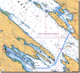 The next morning, September 17, we part ways with the Nagles. They are headed towards Lopez Island where their guest David Cohn’s family has a vacation home. We’ve been travelling with the Nagles for two months and have enjoyed the company and support as we’ve travelled the more remote areas of Alaska and British Columbia.
We head towards Ganges Harbor on Saltspring Island. It is only a short distance, less than 10 miles, from where our anchorage so we are in town with plenty of time to walk around. Our yacht club has an outstation here which means we can stay for only $8 a night, a real bargain compared to the dollar a foot we often pay.
Ganges has a busy art community and there are many galleries. Marcia finds a few items that she likes at a price she is willing to pay. We eat out at one of the many restaurants in town. Besides art, it looks like a good food town, as well.
We reenter the United States the next day, September 18. Besides recreational boat traffic, ferry and commercial traffic is lots higher than up north. We have to dodge BC ferries shortly after leaving Ganges, alter our course to avoid two freighters in Boundary Pass between Canda and the USA, than hug the shore to allow room for Washington State ferries in Thatcher Pass.
As we cruise through Wasp Passage between Orcas and Shaw Islands in the San Juan Islands, we are hailed by a vessel about 200 yards behind us. It was Summer Song a 72 foot Hatteras owned by a couple we met in Ketchikan two months earlier. After conversing with them, we are hailed by another vessel hearing our boat name on the radio. It was Abacus, a Nordic Tug 42, operated by a couple we first crossed paths with on our northbound trip in British Columbia in early June. Its a big cruising area but a small world.
Immigration and Customs clearance was easy as we went through the “trusted traveler” program this Spring and have been vetted by both the Canadian and US immigration services. We are cleared for entry by phone as we motor along Guemes Channel towards Anacortes where we spend the night in the Cap Sante Marina.
The next morning, September 19, we lighten our pocket book and load up on 1042 gallons of diesel at Cap Sante fuel. For a change we have favorable currents, riding the ebb out of Guemes Channel, down Rosario Strait and into the Strait of Juan de Fuca. We pick up the flood as we start down Admiralty Inlet. We pull into the QCYC Winslow outstation dock shortly before 5 PM.
Mileage from Ketchikan – 753.1
Cumulative Mileage – 3208.3
Engine Hours – 512.0


