Wednesday, August 31, 2011

August 27–30 -Prince Rupert to Port McNeill (aka “Now its time to slow down”)

It seemed as though we’ve repeated the frenetic pace of the northbound trip in our southbound journey. We are now docked in Port McNeill after covering the 295 miles from Prince Rupert in four days. The last three days were all nearly 12 hours underway. On account of the shorter days, we started all of of our days before sunrise.

On last year’s southbound trip, because of the time of the month, we frequently encountered opposing currents. This year, we were luckier and did a better job of choosing anchorages so that we could frequently ride favorable currents for much of the day.

On August 27, we revisited Lowe Inlet, an anchorage we used on the northbound trip. We were surprised that no one else anchored here as it is a convenient distance from Prince Rupert and quite lovely.

The next day, August 28, we continued the trip down Grenville and Princes Royal Channels (the “ditch”) and anchored in Mary Cove. This was a new anchorage to us and one we would use again as it is just a short distance off the main channel.

On August 29 we positioned ourselves for rounding Cape Caution by anchoring at Green Island. We anchored here in 2007 with our first boat, Dragontail, and thought it a delightful, well protected anchorage. Our opinion remains the same.

Yesterday, August 30, after some careful deliberation, we made the trip around Cape Caution and across Queen Charlotte Strait to Port McNeill. The West Sea Otter offshore buoy is often used by boaters as a key indicator in deciding in the “go/no go” decision. The 1.7 meter wave height was a bit more than the 1.5 meter cutoff we normally use but the winds were from the NW so we thought we’d have wind waves on our aft quarter. Unfortunately, the winds were forecast to increase to 25 knots in the afternoon. Since there was no forecasted storm and we had bailouts once past Cape Caution, we decided to go for it.

The current pushed us quickly out of Fitzhugh Sound and into Queen Charlotte Sound where we dropped both of our stabilizers into the water. They made a huge difference in cutting down the rolling from the beam on ocean swells and allowed us to continue in relative comfort. Once past Cape Caution the swells seemed to increase but were now coming more from the aft quarter. As we started to lose the current swell, the wind and the wind driven chop was directly behind us. The docking at Port McNeill in 20-25 knot winds turned out fine once we were given an end side tie where the wind blew us onto the dock.

From here we are slowing the pace down. We’ve reserved a space at Pierre’s at Echo Bay in the Broughtons for this weekend’s pig roast and are looking forward to that. We are still targeting a return to Seattle the last half of September.

Total distance this leg was 295.7 nautical miles (in 4 days!) bringing the trip total to 3008.9.

Friday, August 26, 2011

August 25-26 - Thorne Bay to Prince Rupert (aka “Escape from Alaska”)

The weather on Thursday, August 25 was a 180 degree change from the recent weather. We left before dawn to calm winds and flat seas in Clarence Strait. We decided to take as much advantage of it as possible by going as far as we could.

We blew by Ketchikan, intending to get into a good position to reach Prince Rupert with the next available weather window. We next passed by our original destination, Foggy Bay, because we still had several hours of daylight. We ultimately anchor in Port Tongass after nearly 14-1/2 hours of running and with 90.1 miles under our belts.

Fair weather (or at least winds and seas) hold together one more day on August 26  and we cover the last 37.8 miles to Prince Rupert more leisurely. By using Port Tongass, we split the crossing of Dixon Entrance into two smaller sections. The exposed portion of today’s crossing was only 10 miles.

From here, we have generally protected cruising until we reach Cape Caution, the exposed area north of Vancouver Island. That will probably take a week or so. We hope the weather will improve as we head south.

The distance traveled this leg was 127.9 bringing the total to 2713.2 miles.

Wednesday, August 24, 2011

August 12–23 Juneau to Thorne Bay (or “September is two weeks early this year”)

I’ve been using pretty bland blog post titles so as to not to detract from the more journal style entries I am doing this year. The weather we’ve experienced recently its impact on our itinerary and schedule cannot be ignored, though.

After our friends, Sharon & Craig Rowley departed on August 11, we busily reprovisioned at Costco and Safeway for our trip south. Our intent was to head south through Wrangell Narrows and head into the town of Craig on the west side of Prince of Wales Island. From there we’d revisit Cordova Bay, round Cape Chacon at the tip of Prince of Wales Island and then head across to Prince Rupert, B.C., to clear into Canada.
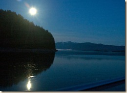
2011-Cruise-874xThe next day, August 12, after adding 200 gallons of fuel to serve as our reserve for the trip home (we’ll do a total refuel when back in Puget Sound), we headed out. The weather kept improving as the day wore on and by the time we pulled into Tracy Arm Cove the clouds were breaking up. We even had a lovely full moon over the mountain towards our south.

The weather remained good on Saturday, August 13, as we went to Cannery Cove, although the crossing was lumpy on account of the interaction between the brisk wind and current in Stephens Passage. We launched the dinghy, set two crab pots and went on the hunt for halibut in Pybus Bay. As we made our way between a couple of islands into the main bay, that same wind and current interaction occurred again. Since we were in the dinghy and not wanting to deal with much if any chop, we beat a retreat and Marcia tried her luck in more protected waters. No luck though. Back at the boat, though, we did catch a glimpse of a brown bear sow with three offspring.

Before we left on August 14, we retrieved the crab pots placed the afternoon before and managed two keeper crabs. Since the weather forecast was for a storm the next day, we decided to try an anchorage that offered good protection, a sticky bottom for the anchor and lots of swinging room for the boat in case we needed to hunker down. As it turned out, Portage Bay on the northend of Kuprenof Island only provided the last two items.
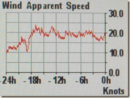
During the morning of August 15, the weather deteriorated as was forecast. The five other boats in the anchorage the night before all cleared out as the morning wore on. We stayed put assuming that while we might have some fetch bringing wave chop as was mentioned in the guide book, it wouldn’t be too bad.  The wind started in the 15 to 25 knot range but picked up to 20 to 30 knots.

What really made it unpleasant was the current that swept past our boat depending on whether the tide was rising or falling. When the tide rose, the wind and current were fighting each other causing the wind driven waves to steepen and become closer together. Additionally, current was strong enough that it pushed the boat upwind. Our boat was the little stuffed animal being pulled (pushed in this case) apart by two children. The worse moments were when we had 3-foot choppy waves hitting the boat broadside because the current was pushing us one way while the wind was pushing us the opposite.

As the tide changed and the current with it, the battle was over and they both pulled us hard against our anchor. Fortunately the bottom was good and the anchor well set. Since everybody else had bailed that anchorage we certainly didn’t worry about swinging into anyone.

The next day, August 16, was a little bit better but not so good that we wanted to head out and fight conditions to either a new anchorage or uncertain docking in Petersburg. We stayed another night in our private purgatory.

At last, on August 17, the weather was much improved and we headed out on a rising tide (did I mention that the entrance to our anchorage was shallow with a dog-leg turn and had a propensity for fast current during tide changes?). We passed Petersburg and went straight in to Wrangell Narrows. This was our first southbound trip through the narrows and it looked different.  Fortunately, we are gaining confidence and while we remain very attentive we aren’t stressed the way were on our first transit through Wrangell Narrows. We made for the very convenient anchorage in St John Harbor, just four miles south of the south entrance to Wrangell Narrows.

The next morning, August 18, we decided to do as many miles as we could since the forecast was for another storm to come through in a couple of days. The ultimate destination kept changing as we rode a favorable current out of Sumner Strait. We ended up the day at Kaguk Cove, an anchorage east of Sea Otter Sound and only 27 miles from Craig, what we intended to be our last town visited before heading into British Columbia.

With the early forecast on Friday, August 19, we knew we needed to get to Craig as quickly and as soon as we could since gale force winds were forecast that evening.  Rain showers were already starting but the winds were still in the teens until we started to head into more open channels, then gusts in the upper 20’s began to buffet the boat. About the same time we picked up a radio transmission from a commercial fishing boat to the Craig Harbor Master. It sounded like everything was filled and the boats were beginning to raft up. At that point we were still 17 miles from Craig and decided to cut our losses and head back to anchorage that we knew was good. After a 20 mile trip to nowhere, we anchored again in Kaguk Cove to wait out the storm.
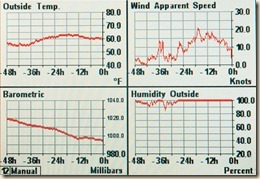
2011-Cruise-898xThe winds picked up during the evening as forecast and continued into August 20. It rained a lot and we spent a lot of time trying to keep the interior windows from fogging up. We monitor some basic weather conditions with the instruments on the boat. What struck us was the dramatic pressure drop during the storm and the rapid temperature rise. The temperature rose during the night from the mid 50’s to the low 60’s. It felt like one of those “Pineapple Express” storms that Puget Sound gets during the winter where a tropical storm from the central Pacific comes barreling into the area.

It was while waiting out this storm and listening to the upcoming weather that we decided that the weather pattern for Alaska had switched to a more autumnal mode and that the storms would be stronger and more frequent than seen in the summer. It was time to abandon every other goal except heading south. For us that meant heading north through (generally) more protected waters back down through Ketchikan and cross Dixon Entrance, the unavoidable open section of water separating Alaska and British Columbia, at the first weather window after positioning ourselves for the crossing.

On August 21, we motored north through El Capitan Passage out into Sumner Strait and headed for Hole-in-the-Wall on the northwest corner of Prince of Wales Island. I became enamored with the description of its entrance and protection as described in the guide book. While everything turned out fine, the entry was nerve wracking as I had to pass one submerged rock on the right then one on the left while ignoring the breaking waves from the following seas on either side of the entry. While the initial entry was as narrow, at one point further in, we concluded it was only 100’ wide. Ultimately, we had a lovely anchorage with very little wind and only a tiny bit of swell working its well through the entrance.

The next day, August 22, the exit from our anchorage was not nearly as stressful as the entry. We continued north around Point Baker, along Sumner Strait and south down Clarence Strait. The winds were forecast at 20 knots but we generally saw winds in the low teens instead. That is, until we turned the corner at Clarence Strait. At that point, winds are in the low 20’s and gusts to the upper 20’s. Since it was on the “nose”, it is more a nuisance than an issue. As we got into the more open sections of Clarence Strait, the pounding got worse but we persevered and pulled into Ratz Harbor for the night. It was a surprisingly protected and comfortable anchorage.

Once again the forecast was for gale force winds on the night of August 23. Until that time, the forecast was for SE 25 knots with 5 foot seas. We got a 0430 start in the dark (it is nearly the end of August after all!). Our goal is to tie up in Ketchikan by early afternoon. Things went well for the first 1-1/2 hours until we started into the central part of Clarence Strait. At this point we start pounding in very short duration 5 foot seas. The bow pitches up and then comes crashing down, nearly burying the anchor (8 feet above the water line) in the water. Fortunately there was a nearby bail out option and by 0815 we are tied up to the transient dock in Thorne Bay.

Later that day, we are joined on the dock by the sailing vessel Noah from Point Roberts Washington. It being the small world it is, we had gone through the Glacier Bay National Park boater orientation with them in early August. Its owners, a very nice couple, Kellie and Terry, concluded similarly to us that while, yes, the boat might be able to handle pounding like we experienced in Clarence Strait there was no reason to do it voluntarily. We spent a pleasant evening talking boats and plans.

Today, August 24, we remain at the dock planning on departing tomorrow in forecasted SE 10 knots with 2-foot seas. We will take advantage of those conditions and go as far as we can get. Hopefully we will be in Prince Rupert, BC this weekend.

Distance covered in this leg (including our “sightseeing” trip of about 20 miles) is 404.3 bringing the total distance traveled to 2585.3 nautical miles.

Tuesday, August 23, 2011

Sitka to Juneau – July 29-August 9

Better late than never.  First Internet since Juneau

_DSC0404x_DSC0060xOur friends Sharon & Craig Rowley arrived from a sun-deprived Seattle to a rainy Sitka on Wednesday, July 27. After a brief orientation, we turned them loose to explore the sights around town. Marcia and I continued with a few boat chores. Since Craig is a better photographer than I am, unless otherwise noted, I am using his photographs in this blog post.

We get underway on Friday, July 29 after lunch and make the short trip to the Magoun Islands, a short distance north of Sitka. Already anchored outside the entrance to the inner cove is the Ursa Major, the boat Marcia traveled from Baja to Seattle on in 2006. We join them there since the shallow entrance channel will be at low tide the next morning when we want to depart.

We have a 6-day permit for Glacier Bay starting on August 3. The weather forecast is favorable so we elect to travel the outside coast of Chichagof Island to Icy Strait over two days. The route we take actually only has two sections on the outside. The first section of 20 miles we do on the first day and the second section of 10 miles we do on the second day.

_DSC0138xThe westerly swell is not large but we drop one stabilizer on the port (weather) side into the water to reduce any rolling. Additionally, it gives us some more experience with the new stabilizers we are using this year. They are significantly lighter than our original stabilizers and are easier to retrieve from the water.

On Saturday, July 30, we pull into Kimshan Cove. The afternoon weather is nice enough that we cook hamburgers on the gas grill on the fly bridge. It isn’t nice enough to eat outside, though.

_DSC0177xThe next day, July 31, we continue the north a short ways than take the Lisianski Strait that separates Yakobi Island from Chichagof Island. We end the day on the public dock in Elfin Cove. We spent several days in Elfin Cove last year with our friends the Dorothy and Dave Nagle. A childhood friend of theirs owns Coho Bar & Grill in Elfin Cove. It had been badly damaged in a fire last year and we lent a hand at the cleanup. This year it was open for business and we had afternoon appetizers there.

The clouds and rain were returning but the next day, August 1, we departed across Icy Strait for Dundas Bay. Although we timed our departure for near slack current, when we made our way through Middle Pass through the Inian Islands, the seas were sloppy on account of the swirling currents. Stellar sea lions were taking advantage of the confused waters to feed on fish that were being buffeted by the current.

We had heard many good reports about Dundas Bay but we’ll have to return in better weather. We ended up anchoring in as protected an area as we could find and watching the wind driven rain buffet us about.

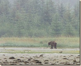
_DSC0185xThe next day, Tuesday, August 2, as we left Dundas Bay we did spot a brown (aka “grizzly”) bear foraging on the beach at low tide. We continued east along Icy Strait past the entrance to Glacier Bay (the National Park Service is adamant that you only enter on the day of your permit). _DSC0202xWe cruised by a popular humpback whale viewing area at Point Adolphus. There were abundant number whales and gave us hope for further viewing while in the park.

We anchored that night in Flynn Cove. On account of it being Marcia’s birthday, Craig did the cooking. Dessert was brownies with cookie dough ice cream.

We entered Glacier Bay on our appointed day, August 3, and attended the boater orientation at the park HQ in Bartlett Cove. There are some hiking trails near Bartlett Cove so we anchored out and dinghied to the public dock to go for afternoon hikes.

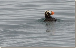
_DSC0252xFor August 4, we traveled past the bird sanctuaries of North & South Marble Island. Stellar sea lions use the haul-out rocks at one end of the island and birds nest in the steeper rock sections along the islands face. Two kinds of puffins, tufted and horned were present on the island. That night we anchored in North Sandy Cove a lovely anchorage we used in 2010 on our visit to the park.

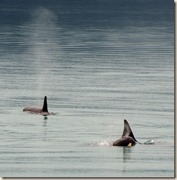
_DSC0289xThe visibility was pretty low when started our cruise the next day, August 5, up Muir Inlet. It is a long way up and we were concerned that we wouldn’t see much. Fortunately, the weather improved to give us some nice views. One unexpected treat was a pod of 4 or 5 orca whales feeding. We saw them both on the way up and the way back. After a long day of motoring along, we dropped the anchor in Blue Mouse Cove.

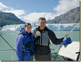
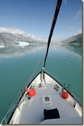
_DSC0345xWhile we saw some glaciers in Muir Inlet, the iconic glacier view in Glacier Bay National Park is Margerie Glacier. Saturday, August 6, was the one day that week in which there were no cruise ships in the park. As it turned out, we had the glacier pretty much to ourselves that morning. In addition, it was the best weather we had had for several days.

We made a 1/4 mile “drive-by” of the glacier front for photo-ops then moved away to a 1/2 mile and shut down the engine. There was no wind and no current so we barely moved 100 yards in the 45 minutes we drifted there. Anchorage that night was in Reid Inlet.

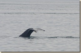
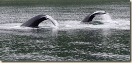
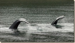
_DSC0522xFor our last night, August 7, in the park we made our way to North Finger Bay. As we were entering the bay, we saw whale spout from 3 or 4 humpback whales feeding in the bay. We put the boat in neutral and drifted 10 or so minutes while whales were feeding around us. We even had a synchronized diving show by two whales 200 yards from the boat. We waited for the whales to move away from the boat before we motored slowly towards the shallow part of the bay.

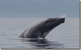
2011-Cruise-830xThe next day, August 8, as we left the park, humpback whales gave us one last show. We saw several whales feeding and breaching a short distance from the boat. After watching them a few minutes while in neutral, we concluded the “show” was over and resumed our motoring along. Suddenly, 300 yards away, a whale breaches the water and comes crashing back. Marcia grabs the camera and races out onto the bow of the boat and waits for another breach. Not wanting to disappoint Marcia, the whale accommodates and repeats its earlier performance twice more.

After the excitement, we make the journey east down Icy Strait where it joins Chatham Strait. We anchor our last night before Juneau in Funter Bay.

On the morning of August 9, before departing Craig and I retrieve the two crab pots we set the night before and find two keeper crabs. The 15 knot winds that start our journey that morning disappear as we approach Auke Bay, a few miles north of downtown Juneau, where we conclude this leg of the trip.

The distance traveled from Sitka to Juneau was 423.4 nautical miles bringing our total distance since leaving Seattle to 2181 miles.

Friday, August 12, 2011

Juneau – August 12

You’d think that I could budget my time better over three days and actually get a proper blog entry describing our trip from Sitka to Juneau with our friends Sharon & Craig Rowley, but I didn’t. I’ll try to work on it while underway during the next leg.

I will upload the following pictures of some really wonderful whale experiences we had in our last 24 hours in Glacier Bay.

2011-Cruise-775xThe first picture was taken after entering North Finger Bay where we anchored the night. It wasn’t until passing the entrance bar that we notice the spouts of the 3 or 4 whales feeding. We put the boat in neutral and as we drifted, the whales continued to feed, sometimes within 200 yards of the boat. After they moved away and had started another feeding dive, we slowly motored to the shallower end of the bay where we anchored for the night.

2011-Cruise-830xThe second picture was taken shortly before leaving the park waters by Point Gustavus. This was a lone humpback repeatedly launching itself out of the water, presumably through a very tasty herring ball.

Our plans from here are to start our return journey south to Seattle. We plan to be back in home waters the last half of September. Next major stop will probably be Petersburg.