Saturday, July 31, 2010

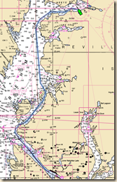
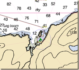
July 31 – Swanson Harbor

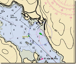
We left yesterday, July 30, for Glacier Bay National Park.  We have a six day permit for entry on August 1.  As an intermediate spot between Juneau and Glacier Bay we went to Swanson Harbor. The state of Alaska has two floats in Swanson Bay and we managed to get a spot on one.

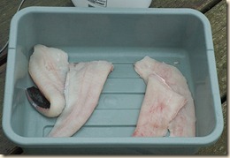
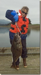
We did a layover day today and went fishing in our dinghy just outside the entry to Swanson Harbor.  Marcia applied all that she learned from talking to a serious sport fisherman in Ketchikan to selecting the fishing location, the type of bait and the method of fishing.  She must have listened well because about 10 minutes after putting her hook down in the chosen site, she hooked a halibut.

2010-07-235x Marcia brought it close to the boat, I gaffed it then Marcia put a couple of shark hooks in it to keep it from getting away.  From hearing warning tales about not putting a live halibut in the dinghy, we tied the shark hooks off to the side of the boat and slowly motored back to our boat.  We brought the fish on the dock and measured it at 31 inches. Based on the table of standard halibuts, the fish weighed about 11-13 pounds.

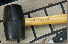
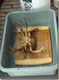
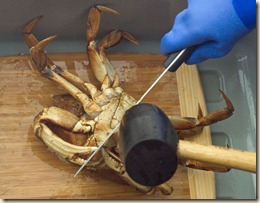
2010-07-239x Besides the halibut which Marcia cleaned and trimmed up, we managed to get three keeper crabs in the two times we dropped the crab pot in Swanson Harbor. Marcia then cleaned, cooked, picked and froze the crabs’ meat.

All in all, it was a very productive stop.

Friday, July 30, 2010

July 30 – A Few Photos

While breakfasting at a local waffle shop, I am taking advantage of its WiFi to upload a few photos of the trip since Petersburg.

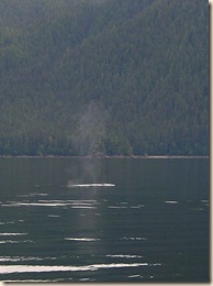
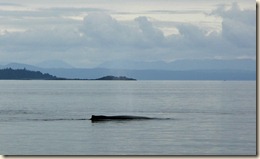
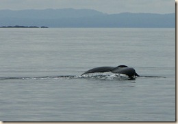
The whale photos are courtesy of Dorothy Nagle.  I never seem to have our camera out and telephoto attached when the whales are nearby.

The sighting usually begins with seeing a whale “spout” at some distance. It looks more like a mist column above the water.

It next progresses to seeing the dorsal of the humpback whale. It is not as dramatic as orca whale dorsal fins but the name “humpback” is clearly appropriate. Humpbacks adults are usually in the 30-50 foot range.

The last image of a humpback is of the terminal dive. After catching its breath swimming near the surface, it makes a big arch with its back, begins its dive and flips its tail out of the water.

After our day of whales getting up to Tracy Cove Arm anchorage, we took our trip into Tracy Arm. The inlet is not particularly wide so we traveled pretty closely with the Nagle’s and their boat the DavidEllis and took many photos of each others boat.

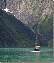
2010-07-180x The first photo (one of mine) is of the DavidEllis with one of the valleys that entered the inlet. The water has the cloudy turquoise appearance on account of the glacial silt in the water.

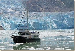
The ultimate goal of the journey was the terminus of the South Sawyer Glacier. We each took turns being the “cover girl” for the other. Since we were using telephoto lenses, it foreshortens the images and makes the glacier appear closer than the actual 3/4 mile we were from it.

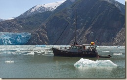
Getting here involved dodging lots of ice chunks (bergie bits and growlers). While a local tourist boat got quite a bit closer to the glacier, to preserver our bottom paint and running gear, where we stopped was perfectly fine with us.

The left image is of us, Alpenglow, and the right image is the DavidEllis.

2010-07-193x

Tuesday, July 27, 2010

July 27 - Juneau

The Internet connection here is very poor so no pictures at this time.

We arrived late this morning in Auke Bay, about 7 miles NW of Juneau proper.  The marinas near downtown Juneau have very little transient moorage and the docking is very tight. Most cruising boats like us tend to head to the larger facility in Auke Bay.

The previous two days have been long but really wonderful. The good weather that we have had certainly has contributed to it.

On Sunday, 7/25, we left Petersburg at 4:30 AM and rode the ebb out of Wrangell Narrows and up Frederick Sound. The day started out foggy but by 9 AM it was burning off nicely. The winds were virtually non-existent so the water was glassy.

Shortly after we passed Cape Fanshaw, where Stephens Passage from the north meets Frederick Sound the humpback whale action took off. During the couple of hours or so we were in that area, we must have had sightings of more than 40 different whales. Our buddy boat the David Ellis even had a couple of humpback whales bubble feed next to them.

After about 74 miles of cruising, our anchorage that night was the very lovely Tracy Arm Cove (aka “No Name Cove”), just north and inside of the entrance to Tracy Arm. Marcia prepared crab-shrimp cakes as an appetizer for everyone.  They were a real hit.

The next day, 7/26, we traveled up Tracy Arm. My best description of the inlet is Yosemite Valley with 1,000 feet of water in it.  It is a beautiful fiord with steep glacial carved mountains on either side.

At the head of the inlet’s two arms are the North and South Sawyer Glaciers. The South Sawyer Glacier is a tide water glacier which means the bottom of its snout is below the surface of the water. As the glacier calves chunks of ice off the snout they crash into the water. The face of the glacier is at least 100 feet so there are some big chunks that fall off.

Even at our anchorage at the entrance of Tracy Arm there was ice floating in the inlet or grounded on shore. The further we traveled up Tracy Arm the more the ice increased. You avoid hitting all but the smallest (shoe box size) chunks of ice. One of the last things you want to do is damage either your propeller, rudder or one of your depth transducers by bumping into a chuck of ice the size the size of a car, weighing several tons. Since 90% of the volume of ice is below the water, you do your best to avoid all ice.  Eventually, we stopped about 3/4 of a mile from the South Sawyer Glacier because the ice was packed in so much that we couldn’t get through without turning ourselves into “snow plows.”

It is 20+ miles up Tracy Arm and you have to do that same distance to get back out. We than ran another 25+ miles up the coast to Taku Harbor where there is an Alaska state dock.  We arrived there about 8:30 PM making for another long day.

We left today at 4:30 AM in order to have as much time in Juneau for the Nagle’s nieces to visit a few Juneau sites before they leave tomorrow. While the trip was about 33 miles, it was slow on account of the continual opposing current. That compensates for the good current we experience a couple of days ago.

While they were touring, Marcia got on the phone and obtained a permit for cruising Glacier Bay National Park, about 50 miles west of here. The park service only allows 25 private cruising boats in the park at a time.  Our date of entry is Sunday, August 1.  More details of our plan later.
Saturday, July 24, 2010

July 23-24 – A Tale of Two Cities; Wrangell to Petersburg

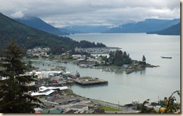
2010-07-23 Petersburg Route2010-07-139x We left Wrangell (photo right) in the steady rain at 8 AM in order to arrive at Wrangell Narrows at the appropriate time to transit the narrow 20 mile route to Petersburg. We got there a bit early on account of favorable currents which meant we had to watch our path through the narrows as we wound our way through the many (50+) navigation markers. Fortunately the opposing traffic was light and we had no major issues.

Docking at Petersburg was a bit more challenging as the wind picked up about the time we arrived. A little bit of drama accompanied the docking but that is par for the course when the wind is blowing 20 knots.

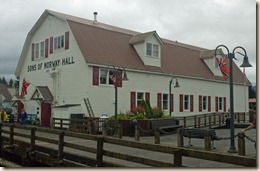
2010-07-148x Petersburg is what you would envision an Alaskan fishing town would look like. It celebrates its Norwegian heritage so I felt right at home here.

From here we will continue north to Juneau with a swing into Tracy Arm to see the tidewater Sawyer Glacier. We also hope to start seeing more humpback whales which are reportedly feeding along the route we are taking.

Today’s mileage – 40.0

Cumulative mileage – 1368.9

Wednesday, July 21, 2010

July 21 – Anan Bay & Wrangell

A busy day today. While not as early a start as yesterday, we still managed to take our dinghy out at 5 AM and pull a crab pot we left soaking all night that contained one keeper crab and then get going from Santa Anna Inlet by 6 AM. We had about 15 miles to Anan Bay to cover.

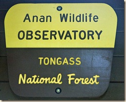
2010-07-115xEntrance to the Anan Wildlife Observatory is controlled and we got the last permits for the day when Marcia reserved them on Monday. Because we had an additional 30 miles to travel afterwards, we wanted to arrive not to long after they opened. We were anchored about 8:30 AM.

The anchorage in Anan Bay is poor and boaters are advised to not leave their boat unattended while ashore. That meant that we had to visit the observatory in two waves using a dinghy to ferry ashore.

While the weather had deteriorated and the rain began in earnest, at least the wind was pushing us in a fashion that kept our anchor tight. We use our GPS to monitor our position and it showed we hardly moved while at anchor.

2010-07-099xThe observatory was great! A half mile walk from shore leads to a viewing platform above the stream rapids. Bears are the main wildlife viewed and when the salmon are running, the bears are there.

Before leaving shore, a Forest Service ranger briefs you on what to do if you encounter a bear along the trail. Another Forest Service ranger at the viewing platform makes sure you follow the rules while viewing the bears.

2010-07-084x

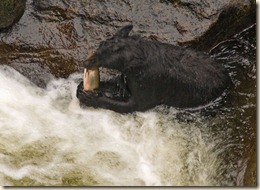
Both black and brown (aka grizzly) bears frequent the area. During our visit, the black bears were hanging around the steeper drops and trying to snag salmon as they leaped from pool to pool going upstream.

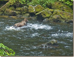
2010-07-120xThe brown bear we saw had a different fishing style. Perhaps because of its greater heft, it worked the lower portion of the stream and would trap the fish against the stream bed. It would then pull them out to eat on shore.

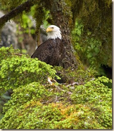
2010-07-093xBoth the black and brown bears seemed to eat only the choice portions of the salmon (a surprisingly small portion) and leave the remaining carcass on shore. The many eagles hanging around would then swoop down and begin eating the remainder.

07-21 - Wrangell RouteWe retrieved dinghies, had a bite to eat and were underway about 2 PM. We covered the nearly 30 miles to Wrangell slowly because we had an opposing current of a knot or two almost the entire way. We were moored in Wrangell about 6:30 PM.

Today’s mileage – 44.1

Cumulative mileage – 1328.9

Current position


Tuesday, July 20, 2010

July 20 – Santa Anna Inlet

07-20 - Santa Anna InletIn order to beat the typical afternoon winds, we left Ketchikan bright and early at 4:15 AM. While it can be a challenge to get yourself moving that early, the payback is usually calm seas and lovely early light.

Our goal for today was Santa Anna Inlet, about 53 miles from Ketchikan. This will put us in good position to visit the Anan Wildlife Observatory early tomorrow.

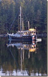
The weather the last several days has been excellent and it continued today. We anchored shortly after 12 PM in bright sunshine. We had to open all of the windows in the boat to keep it from becoming too hot.  Who would have thought.

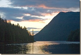
2010-07-075xThe Inlet is oriented NNW which gave us late evening light and a terrific sunset. The calm wind allowed for near mirror-like reflections. The photos, of course do not do it justice. Marcia and I enjoyed a last glass of wine on the fly bridge as the sun set.2010-07-073x

Today’s mileage – 53.6

Cumulative mileage – 1284.8

Current position

Sunday, July 18, 2010

July 17-18 – A Weekend in Naha Bay

To give Dave Nagle’s brother and sister-in-law a brief taste of Alaska cruising, we did a short 20 mile trip from Ketchikan to Naha Bay. There is a public dock there and trails that go to some upland lakes.

The dock is a bit small so Dave went in first and I rafted to him on the outside. Unfortunately, while waiting for Dave to dock and my focus on him the wind pushed us a bit to close to the shoal outside a stream emptying into the bay.2010-07-059x Faster than I can say “oh #@!&” our stern drifted into the soft bottom and we got stuck.  Our bow float proudly the entire time.

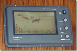
Fortunately, we were only an hour before low tide and we easily floated off about two hours later.  Dave and crew gave us a hand by taking our anchor in their dinghy and dropping it 100 feet away in the deep water so tantalizingly close as seen in the image taken of our forward looking sonar screen (as an aside, the FLS is at the lower helm and I was at the upper helm because that is where I dock from). As we floated clear, we took in anchor chain to help pull us away from the shallow. Dave in his dinghy simultaneously pushed us along at our stern.

2010-07-064xThe rest of the weekend was extremely pleasant as the weather improved. Marcia prepared a wonderful halibut cioppino for everyone using fish that was given to her by Justin from the fishing boat Little Lady.  Marcia has discovered that chocolate chip cookies are an effective bait for “catching” fish.

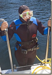
2010-07-071x On Sunday, before departing back to Ketchikan, Marcia and Dave dove our boat using Dave’s hookah gear (an air compressor operating on deck and supplying air via hoses). It was the first time Marcia (photo right in case you don’t recognize her) has dived on compressed air since college. Fortunately, our brief grounding caused no harm and it gave Marcia a good excuse to dive under the tutelage of Dave, a certified dive instructor.

We returned to Ketchikan at about 5:30 PM in the warm sun and enjoyed our post docking beer, chips and salsa on our fly bridge.

Roundtrip mileage – 41.9

Cumulative mileage – 1231.2

Wednesday, July 14, 2010

July 14 – MV David Ellis

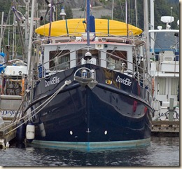
2010-07-057x Our friends Dorothy and Dave Nagle on board their vessel the David Ellis arrived in Ketchikan today around 3:30 PM. We monitored the radio so knew which slip they were coming in to and were there to catch their lines.

We kidded them about having a floating party all the way up because on board were 7 people and 1 dog. Accompanying them were Dave’s brother and his family (4 people) and a visiting Australian friend of Dave. Their dog, Rusty, was one they adopted in Hong Kong. Rusty has far more sea time than we do since he was on board during David Ellis’s trip last year from Hong Kong to Seattle via the Aleutian Islands. The blog of their travels is at Semper Gumbi.

Dave’s brother and sister-in-law leave Ketchikan for their home in California on Monday. Dave’s two nieces will cruise with them for an additional week before also flying out from Ketchikan.

Now that we are assembled we can begin making  plans for travels further north. Sitka and Elfin Cove (north of Sitka, near Glacier Bay) are on the Nagle’s desired list.  We’re pretty flexible and not locked into any firm commitments. Details later.

Tuesday, July 13, 2010

July 13 – Back in Ketchikan (again)

We left Meyers Chuck early to make the 30+ mile trip down Clarence Strait and Tongass Narrows to Ketchikan. We docked about 10:30 AM which gave us lots of time to do a few chores.

We picked up at the post office the two packages of material from Fisheries Supply in Seattle that we had ordered before we left last week. In one package was some high-tech rope that I used to replace the wire cable that came with it. Some of the wires in the cable had begun to break as a result of the repeated flexing launching and retrieving the dinghy and were becoming a “poke” hazard when handling the cable.

Our friends the Nagles on the MV David Ellis called and said they were south of Prince Rupert but expected to make the leg across Dixon entrance the next day. They have made fabulous time from Seattle having left on July 5.

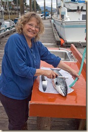
2010-07-050x While in Meyers Chuck Marcia bought a Coho (silver) salmon from a local fisherman. While he gutted the fish, Marcia got to practice her skills at scaling and filleting it. Fresh salmon for dinner tonight!

Today’s mileage – 33.1

Cumulative mileage – 1189.3

Current position

Monday, July 12, 2010

July 12 – Meyers Chuck

The wind died down overnight and the clouds were broken when we awoke. For our destination today, Meyers Chuck, we decided on an early departure even though it we had to travel only about 30 miles. As it turned out, that was a wise decision.

DSC_7831x We hoisted the anchor at about 6:30 AM. We had to work a bit to loosen the anchor from the gooey, stinky mud but that is a small price to pay for being able to sleep well at night knowing that you aren’t going to drag your anchor should the wind really pick up.

The clouds were broken and lots of sun shone on ourselves and the surrounding islands through which we traveled. The seas were only slightly choppy so the trip was pretty pleasant.

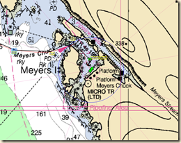
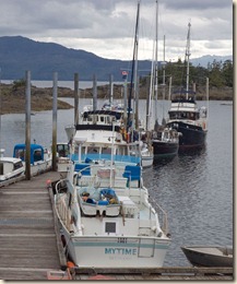
07-12 - Meyers Chuck Moorage We reached Meyers Chuck, a small community of a couple dozen residences, about 10:40 AM. What makes this a good stop is the state government dock providing free moorage. There isn’t any electrical power so you have to run off your batteries but not having to fuss with your anchor and being able to walk off the boat is a real plus.

DSC_7843x When we arrived, there was one other transient pleasure boat like ours at the dock so we had no problem tying up. There were lots of boats of the locals but they tend to be small craft and tie up in the spots that larger boats like ours would find difficulty reaching.

As I write this in the evening, the dock has six transient pleasure craft tied up and four more anchored out in the bay. Because we got here early, we were able to get a spot at the dock’s end so our departure tomorrow morning will be relatively easy.

Today’s mileage – 29.3

Cumulative mileage – 1156.2

Current position

Saturday, July 10, 2010

July 10 – Thom’s Place

We got an early start out of Thorne Bay because the bay’s entrance has one narrow section that can have current pushing you around during the tidal exchange. We transited it at the low water slack and it was easy.

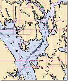
07-10 - Thom's Place Route Our destination today is across Clarence Strait from Thorne Bay, so off we went. Unfortunately, the following seas from yesterday are now more on our beam and the “rollies” become uncomfortable for us and alarming to the cats. We adjust our course a little more northerly so as to have the waves on our aft quarter and things calm down a bit.

Either because the 15 knot SE winds blowing up Clarence Strait don’t make the corner or the winds have died down, but the seas flatten out totally as we entered Ernest Sound. A thin fog and low level cloud cover bedeck the shores and islands along the route. We enjoy this cruising far more than slogging the bouncy waters of Clarence Strait.

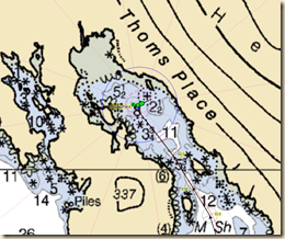
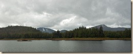
07-10 - Thom's Place Anchorage The distance traveled today is about the same as yesterday and on account of our early start we arrive at Thom’s Place shortly before noon. Thom’s Place is an undeveloped state marine park, no facilities but no development anywhere in sight. A very different type of location than Thorne Bay.

The bay is reputedly a good crabbing location so we drop a pot a short distance from the boat using the kayak. A small commercial crabber has a dozen floats dotting the bay as well.

Besides the crab pot, Marcia tries her hand at a “meat hook” from the stern. While in Ketchikan, we ran into a couple, Jill and Doug Princehouse (MV Passages, Ocean Alexander 50), from the Queen City Yacht Club to which we belong. Doug is a serious fisherman and on his previous trips to Alaska he has effectively and conveniently hung a fishing pole from his stern hanging 10 feet above the bottom, a “meat hook” as he called it. Worth a try, we think.

2010-07-028x Our plan is to spend a two nights here than start back towards Ketchikan and meet up with our friends the Nagles who will be arriving soon on their vessel.

Today’s mileage – 37.9

Cumulative mileage – 1126.9

Current position

Friday, July 9, 2010

July 9 – Thorne Bay

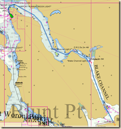
07-09 - Thorne Bay Route We are off again for another short, 4 to 5 day, cruise out of the Ketchikan area. Tonight’s destination is Thorne Bay, about 30 air miles NW of Ketchikan up Clarence Strait and on Prince of Wales Island.

Clarence Strait is the main artery into Alaska inner waters from the south. Cruise ships and commercial traffic from Seattle use it regularly when heading towards Juneau and the other communities in the Alaska Panhandle.

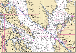
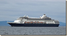
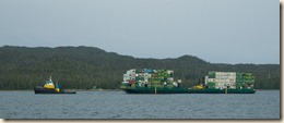
As part of our installed electronics we have AIS (Automatic Identification System), which receives navigation information about other AIS equipped vessels and transmits our navigation information. It is especially useful when staying out of the way of the cruise ships and barges because their position and route is displayed on our chart plotter. We can make small adjustments to our course well ahead of time rather than having to make large adjustments at the last minute.

2010-07-024x2010-07-023x 

Clarence Strait is wide enough that winds and ocean swells travel a long way up it which can make for a bumpy ride at times. We had the seas on our aft quarter so our auto pilot had to work a bit harder as the following seas would push our stern slightly off course. As we approached the entrance to Thorne Bay, the seas flattened out and entering the bay was not a problem.

07-09 - Thorne Bay Anchorage Prince of Wales Island has an extensive road system in its interior to access logging areas. They also connect the many communities on the island. Thorne Bay is one of those small communities and our anchorage is not the “wilderness” experience we’ve grown accustom to in recent weeks. There is a small marina here, many homes around the bay’s interior and considerable small boat traffic. It is, though, a safe and comfortable anchorage with good holding.

Today’s mileage – 36.9

Cumulative mileage – 1089.0

Current position

Thursday, July 8, 2010

July 7-8 - Ketchikan

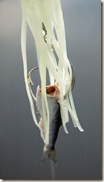
DSC_7808x Marcia got up early (4:30 AM) yesterday to try her luck at halibut fishing from the back of our boat at anchor.  The fish hanging out there proved elusive although it did make an appetizer of the herring Marcia offered it on her squid lure.

With the fishing done for the morning, we hoisted the anchor (finding some old fishing lines and hooks draped across it) and were underway about 5:30 AM. The further south we went in Behm Canal the better sunny and warmer the weather became.

As we turned the corner towards Ketchikan, though, the wind from the northwest picked up and by the time we reached the Bar Harbor Marina, it was blowing 15 to 25 knots. During the docking, I added another paint scuff mark to the collection I have accumulated in the last six months.

DSC_7809x The weather in Ketchikan is terrific, lots of sun and temperatures in the upper 70’s. We’ve had to break out the sun screens we had made in China. 

Bar Harbor Marina where we are staying has lots of working fish boats coming and going. The pleasure craft typically “hot bunk” the slips vacated by the fishing boats that are out working. In fact, after we had lunch, the harbor master knocked on our boat and asked us to move because the permanent resident of the slip we were initially assigned called to say he was returning that evening. Fortunately, a member of the harbor master staff was at the other slip to catch our lines when we moved because the wind was still blowing strongly.

Today’s mileage – 42.4

Cumulative mileage – 1053.1

Tuesday, July 6, 2010

July 6 – The Carnage Continues

2010-07-008x Marcia continues to do well with her taking from the “seas bountiful harvest.”  The tally is six keeper crabs (out of 13 pulled up in our traps), 7 large spot prawns in today’s haul from the prawn trap, and two rock fish. Halibut and salmon continue to elude her although she is starting to get nibbles as evidenced by the chunks taken from the herring Marcia is baiting her hook with. She is very good now at getting her herring bait to spin enticingly as they are trolled through the water.

Since crab has been our predominant catch, Marcia is honing her processing skills. The technique she uses is very different than the “flashy” (and messy) method of putting a live crab in a pot of boiling water. It involves a quick kill using a cleaver, cleaning the now split crab and discarding the inedible portions before cooking. This avoids contaminating the meat with any toxins concentrated in the crabs organs.

2010-07-007x


2010-07-009x

Monday, July 5, 2010

July 5 – Klu Bay

2010-07-013x The weather continued to improve overnight and the day dawned only partly cloudy with significant sun breaks. The winds are calm so the water was glassy as we pulled our crab and prawn trap. The crab trap had one very feisty keeper missing a claw (probably the result of his attitude). The prawn trap was bare of prawns but did have a half dozen or so really interesting small crab/lobster crustaceans. Since we couldn’t identify them, we threw them back into the water.

07-05 - Klu Bay Route Today’s destination was Klu Bay, a short distance from Neets Bay but the route required going back out to Behm Canal and travelling north a short distance before cutting in again. We motored slowly in order to give a reasonable length of time for the alternator to recharge our batteries. 

Just before entering Klu Bay, while still in the deeper waters of Shrimp Bay, we dropped the prawn trap. Will let it soak overnight and will check it tomorrow with our dinghy.

07-05 - Klu Bay Anchorage Klu Bay has a USFS mooring buoy but the luck we enjoyed in Misty Fiords ran out and someone else was already using it. One other boat was also anchored. We dropped our anchor in the water as well and let out over 300 feet of chain to give us sufficient scope in the nearly 100 feet we were anchored in. Fortunately, Klu Bay is large with plenty of room to swing.

In the afternoon, we watched a black bear cruise shore grazing on the lush grass. Until the fish begin running in earnest and the berries ripen, grass is a big part of a bear’s diet.

Today’s mileage – 18.9

Cumulative mileage – 1010.7

Current position

Saturday, July 3, 2010

July 3 – Neets Bay (Fire Cove)

After spending several days in Ketchikan doing boat chores (e.g., marking chain, replacing the chain gypsy and replacing the failed lower helm bow thruster control), we made a break for it. The Independence Day Holiday weekend weather forecast was not great but we’d rather be at anchor in a quiet cove in the rain versus than hanging around the marina.

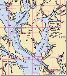
07-03 - Neets Bay Route After discussing options for a 4 night excursion, we decided to head back up Behm Canal on the west side of Revillagigedo Island and check out some of the anchorages that mention good fishing or crabbing. Marcia is especially keen to get a salmon, preferably a King salmon. Neets Bay as our first stop looked promising as there is a fish hatchery at its head and the normal King salmon catch limit is increased.

Southeast winds pushed us along Tongass Narrows as we left Ketchikan but dropped off rapidly as we turned the corner in Clover Passage. Marcia even tried trolling from our rear cockpit but only had a nibble, as indicated by the small bite taken from the herring she was trolling with.

07-03 - Neets Bay Anchorage As we entered the small cove behind the island we would anchor, we spied a black bear walking along a shoal bared by low tide extending from the island.  A few hours later, we saw the bear paddle the short distance to shore, shake itself off and walk into the forest.

Besides the bear, shortly after we anchored and were eating lunch, we spied a submerged shoal not far from the stern of our boat. Concerned about bumping it during the next low tide cycle, we took in a little chain on our anchor to get us further from the shoal.
While the rains fell during the afternoon, Marcia prepared herself for a round of fishing the next day. We launched the dinghy during a brief lull in the rain.

Today’s mileage – 36.2

Cumulative mileage – 991.8

Current position

July 3 – Neets Bay (Fire Cove)

After spending several days in Ketchikan doing boat chores (e.g., marking chain, replacing the chain gypsy and replacing the failed lower helm bow thruster control), we made a break for it. The Independence Day Holiday weekend weather forecast was not great but we’d rather be at anchor in a quiet cove in the rain versus than hanging around the marina.
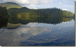
07-03 - Neets Bay Route After discussing options for a 4 night excursion, we decided to head back up Behm Canal on the west side of Revillagigedo Island and check out some of the anchorages that mention good fishing or crabbing. Marcia is especially keen to get a salmon, preferably a King salmon. Neets Bay as our first stop looked promising as there is a fish hatchery at its head and the normal King salmon catch limit is increased.

Southeast winds pushed us along Tongass Narrows as we left Ketchikan but dropped off rapidly as we turned the corner in Clover Passage. Marcia even tried trolling from our rear cockpit but only had a nibble, as indicated by the small bite taken from the herring she was trolling with.

07-03 - Neets Bay Anchorage As we entered the small cove behind the island we would anchor, we spied a black bear walking along a shoal bared by low tide extending from the island.  A few hours later, we saw the bear paddle the short distance to shore, shake itself off and walk into the forest.

Besides the bear, shortly after we anchored and were eating lunch, we spied a submerged shoal not far from the stern of our boat. Concerned about bumping it during the next low tide cycle, we took in a little chain on our anchor to get us further from the shoal.

While the rains fell during the afternoon, Marcia prepared herself for a round of fishing the next day. We launched the dinghy during a brief lull in the rain.

Today’s mileage – 36.2

Cumulative mileage – 991.8

Current position