Friday, June 4, 2010

June 4 – Allison Harbour

When we awoke this morning, low gray clouds hung over Turnbull Cove. But even then hints of blue beyond could be seen and by the time we pulled the anchor around 8 AM, you could tell it was going to be a very nice day.

Allison Harbour Route We exited the Broughton’s through Wells Passage and turned right outbound along Queen Charlotte Strait.  The water was only lightly rippled as we motored along in the sunshine that has been so rare thus far on our trip.

The further along we went, the more evident became the ocean swells rolling past the north end of Vancouver Island. The shore and its vegetation reveal that we are no longer in protected waters. Trees are lower and the exposed rocks pounded by the surf are bare of sea life.

Allison Harbour Anchorage Tonight’s anchorage, Allison Harbour, is one of the last good anchorages before rounding Cape Caution. We can wait here, well protected, until we get the weather and sea conditions we want.

Today’s Mileage – 40.5

Cumulative Mileage – 410.8

Current Position

Thursday, June 3, 2010

June 3 – Turnbull Cove

Turnbull RouteWe poked a little further along the way north but stayed in the protected waters of the Broughton’s.  Today’s destination was Turnbull Cove just off of Grappler Sound.  In 2007 we visited a couple of nearby anchorages but based on the recommendations of another boater at Waddington Bay we decided to give Turnbull Cove a try.

Turnbull AnchorageWe pulled anchor shortly after 9 AM and had the anchor down and secured in Turnbull Cove just shy of 1:30 PM.  We tend to cruise around 7 knots, plus or minus, depending on the current.   Today we had a bit of both.

After we arrived, we had lunch and then dropped the kayaks in the water.  From the north shore of the cove is a short trail to a very large lake (visible just above the cove in the chart to the left). 

Despite the rain shower (rain drops visible in the photo below) it was a lovely walk in the woods.

Today’s Mileage – 26.9 miles

Cumulative Mileage – 370.3 miles

Current Position

Tuesday, June 1, 2010

June 1 – Waddington Bay

We made our getaway about 11 AM after completing our 100 hour oil change (at 134 hours).  This is the last break-in oil change so we are on the regular schedule now.

While the weather wasn’t too bad (occasional showers and light wind) when we left, it was forecast to deteriorate later in the afternoon. We wanted an anchorage that was protected and relatively close.  Waddington Bay on Bonwick Island fit the bill.

Waddington Bay Route After a 23 mile run, we pulled into Waddington Bay, where we turned out to be the only one there (although two more boats followed us in).  We chose a spot with good swinging room because a boat tends to swing about on its anchor in winds.Waddington Bay Anchorage

Based on the weather forecast, we will probably spend two nights here. After that, we’ll look for another pleasant anchorage in the Broughtons.

Besides being a scenic area with many protected anchorages, the Broughtons are well positioned for moving north around Cape Caution when the weather permits.

Today’s mileage – 23.2

Cumulative mileage –343.4

Current position

Sunday, May 30, 2010

May 30 – Port McNeill

It was a relatively short run down Johnstone Strait to Port McNeill. The weather continues unsettled with clouds, wind and showers. We arrived in at the Port McNeill shortly after 10 AM and were glad to do so because the winds were forecast to pick up to 20-30 knots this afternoon.

The highlight of today’s leg was having a pod of dolphins surf our bow wake for ten or so minutes. The Robson Bight area in Johnstone Strait where we picked up our friends is famous for orca whale viewing but we drew a blank.

We’ll spend at least two nights here getting some service done on the engine, doing laundry and some provisioning before the next leg up the Central B.C. coast. On our 2007 cruise we also used Port McNeill for these chores and found everything an easy walk from the marina.

2010-05-074xTo the right is a picture of Alpenglow at the dock in the rain.  Someday the sun will shine, won’t it? 

Today’s Mileage – 33.8 miles

Cumulative Mileage – 320.2 miles

Saturday, May 29, 2010

May 29 – Port Harvey

We spent a lay day on May 28 in the Octopus Islands and are moving again today.  We did an “oh-dark thirty” departure to catch the slack before the ebb at some narrows a couple of miles north.  From there it was a short run down to Johnstone Strait.

In Johnstone Strait, between the wind on our nose, the strong ebb current pushing us along, and the eddies with the current, it was a bit bouncy at times as we motored along. The cats hunkered down and silently cursed us for bringing them.
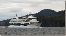
2010-05-064x Not long after we entered Johnstone Strait, we were passed by a CruiseWest small cruise ship, the Spirit of Yorktown, on its way to Alaska.

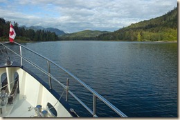
We turned up Havannah Channel and then into Port Harvey where we are currently anchored behind Range Island. There is a surprising amount of activity here.  2010-05-070xBarges and equipment associated with logging are stored here and a few folks have vacation homes.   In 2009, a small marine resort opened up and three power boats are tied at their docks. Besides ourselves, two sailboats are anchored out.
2010-05-069x

Tomorrow we are targeting Port McNeill.

Today’s Mileage – 53.4 miles

Cumulative Mileage – 286.4 miles

Current Position

May 27 – Octopus Island Marine Park

The night in Drew Harbor was pleasant with virtually no wind the entire night. The rain stopped overnight and the day started with broken clouds.

We did a leisurely start because we had to time our arrival at Surge Narrows to be slack (the time when the current is the minimum as it changes direction). Slack was around 10:20 AM so we raised our anchor at about 8:45 since we only had 9 miles to cover.

Octopus Island Marine ParkWe dropped our anchor and had the engine off at 11:30.  To the right is a screen clipping from the charting program I use to drive the boat that shows where we are and the route we followed. The narrow channel we came in on was straight and fair although narrow as it was low tide.


Before HaircutSince we had a free afternoon, it was time to open up Marcia’s barbershop and give Kurt a clipping. We decided to use the #0 clipper for a nice close trim. After HaircutWe think the before and after photos convincingly demonstrate that point.


Daily Mileage - 15.1 miles

Cumulative Mileage – 233 miles

Current Position

Wednesday, May 26, 2010

May 26 – Drew Harbor

We took advantage of a very calm (but drippy) day on the Strait of Georgia to run its length from Nanaimo to Drew Harbor on the East shore of Quadra Island. We covered 78.6 miles from the dock in Nanaimo to where we dropped the anchor.

The wind started out at 15 knots but by the end of the day we were around 2 knots and the water seemed syrupy. You could see the rain drops rings on the water’s surface.  You could not have asked for easier conditions on the Strait.

Quadra Island is accessible from the ferry in Campbell River and there are homes on the west shore of the Drew Harbor and a marine park (Rebecca Spit) on the east shore.  I have managed to steal an open WiFi signal from someone and have used it to post this entry (so much for being in the wilderness).

Tomorrow is the short day through Surge Narrows and into the Octopus Islands.

Today’s Mileage – 78.6

Cumulative – 217.9

Tuesday, May 25, 2010

At Rest - Nanaimo

We spent the day in Nanaimo doing some “freshie” provisioning. Since both Canada and the USA restrict many fresh food items (e.g., vegetables and fruit) when crossing the border, you have to pick those items up shortly after entering the country.

Besides the food items, we bought a prepaid Canadian phone card for our cell phone so we can make cheaper calls than if roaming on our current T-Mobile plans. We also picked up more beer and wine (you are also restricted on the amount of alcohol you can bring in). We did some of our provisioning at the Nanaimo Costco store, taking the bus to and from the harbor to get there.

Despite the rainy night and morning, the sun burned its way through the cloud cover to be a pretty nice day as shown in the photo of Alpenglow at the dock.2010-05-058xThe forecast is looking good for tomorrow (5/26) and we plan to take advantage of it and do a long run the length of the  Strait of Georgia to Drew Harbor (Rebecca Spit Marine Park) on the East side of Quadra Island. This will put us in a good position to go up Hoskyn Channel and through Surge Narrows the next day into the Octopus Islands Marine Park. After that we’ll continue North along Okisollo Channel and reconnect with the Discovery Passage north of Seymour Narrows. We’ll probably follow Johnstone Strait until we can cut off to one of the protected routes into the Broughtons near Cracroft Island.

Anchoring will probably be the norm during this section so blog posts will have to wait until we get reconnected in a community or marina.