Monday, August 30, 2010

Ketchikan – August 30

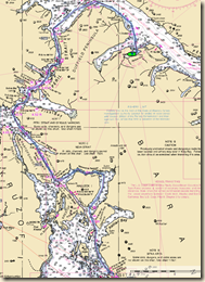
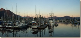
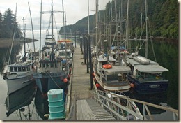
After six weeks of poking around north and west of Ketchikan, we motored back into Bar Harbor marina this afternoon.

Before pulling in, we stopped at the fuel dock and took on 200 gallons of fuel. I estimate that we had somewhat over 300 gallons of fuel remaining which ought to be enough to get home but the 200 gallons is our reserve so that we don’t worry. At the engine RPM we typically motor (~1500), we use about 2 gallons per hour and average pretty close to 7 knots which is a bit over 3 miles to the gallon.

We can certainly tell that the cruising season has pretty much ended here. The pleasure boats still in the marina tend to be homeported in Alaska. We don’t see many folks on the docks that look like cruisers, mostly commercial fisherman.

The weather is also telling us it is time to head south. The forecast is for rainy and windy weather the next several days. We will head towards Canada at the first weather window. Once past Dixon Entrance, we can travel a couple hundred miles in pretty protected waters.

Today’s mileage – 38.0

Cumulative mileage – 2455.2

Sunday, August 29, 2010

August 29 – Gardner Bay

What a great day! First, the weather was perfect, light winds and partly sunny as the day wore on. Second, the scenery was spectacular as we motored through protected channels created by the dozens of little islands in the bay. Lastly, we had some unforgettable whale viewing.

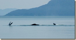
2010-08-443xThe highlight was the pod of 4 or 5 sei or fin whales (we aren’t sure which) that we saw. These are bigger than humpback whales and exhibit different behaviors than humpback whales. For the DavidEllis, they had an additional treat seeing a lone orca grab a seal for its dining pleasure.

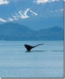
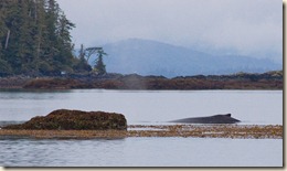
The picture to the right is of a humpback that was using a rock at the entrance of a pass between some islands to which we were heading as its scrub brush. Later we saw another humpback doing likewise on rocks next to the shore almost inside the pass.

2010-08-29 Route After clearing the islands into the main part of Cordova Bay we continued around Cape Chacon and then up to our anchorage in Gardner Bay, on the SE shore of Prince of Wales Island.  Despite our being exposed to ocean swells from the time we cleared the islands in Cordova Bay until we nearly in Gardner Bay, they were very low and the cruising was very comfortable.

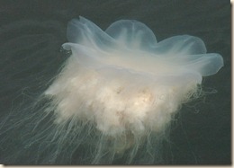
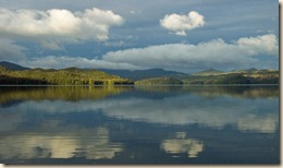
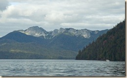
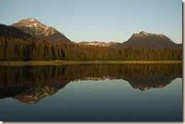
2010-08-462x The anchorage turned out even nicer than we expected. Rocky peaks rose from beyond the head of the bay. In addition, we had some really interesting jelly fish undulate past us.

Today’s mileage – 42.0

Cumulative mileage – 2417.2

Current position

Saturday, August 28, 2010

August 28 – Kassa Island Bay

We departed at oh-dark thirty in order to hit slack at Tlevak Narrows, about 19 miles from Craig.  Even though we were only about forty minutes past slack, we already had a 2 knot current (in our favor fortunately) in the narrows and nearly knots after exiting. Fortunately, the whirlpools and overflows the guide book talked about had formed by then.

The original goal for the day was to pass around the bottom of Prince of Wales Island at Cape Chacon. The day before, the weather forecast suggest that tomorrow (8/29) would be marginal.  After listening to the updated forecast, we realized the front was delayed so pulled up short for the day and went into a lovely anchorage, Kassa Island Bay.

2010-08-437x The area we are transiting is seldom visited by recreational boats because it is a little out of the way from the main routes between Ketchikan and points north or west.  People are missing out because it is lovely area and offers some great opportunities.

We saw a number of humpback whales and one occasion had to back off to neutral because a whale passed within a few hundred yards of us and we weren’t sure where it was going to come up.  As far as sea otters, when the DavidEllis entered the bay in which we were anchoring, they startled a big pod of sea otters which took off away from them by porpoising through the water.  That was a behavior none of us had ever seen in sea otters, who are mostly blasé about boats. We speculated that the otters may be hunted by the native Americans who live at Hydaburg, a community about 20 miles away, and are more fearful of boats.

Today’s mileage – 53.2

Cumulative mileage – 2375.2

Current position

Friday, August 27, 2010

August 27 – Craig

We got a fairly early start in order to get close to slack water through the Tonowek Narrows. The cruising was pleasant and we arrived in the town of Craig shortly after 12PM.

2010-08-432xAlong the way, we saw the requisite sea otters. We also had become sensitized by our caving experience to the many exposed rock formations, likely limestone, on the island.2010-08-434x

Craig is the major community on Prince of Wales Island. Its population today is about 1200 people, supported mostly by fishing, both commercial and sport. Prince of Wales Island has been heavily logged in the past and the island is laced with logging roads. Clear cuts are very common and many forests are second growth.

Logging today, though, is not common in SE Alaska. The practice of clear cutting can severely damage the salmon streams besides creating a long-term eye sore. The fishing industry and conservation have pretty much won out over the logging industry.

Today’s mileage – 37.7

Cumulative mileage – 2322.0

Current position

Thursday, August 26, 2010

August 26 – Cyrus Cove

From Dry Pass Lagoon, we traveled a few miles further and anchored a short distance from the dinghy dock for the El Capitan Caves. In hindsight, we probably should have skipped last night’s anchorage and just anchored here.  Next year, maybe.

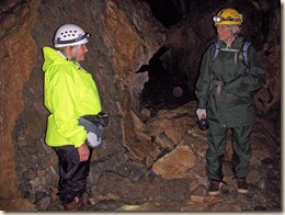
The caves are in the Tongass National Forest and managed by the US Forest Service. For safety, the USFS has secured the caves and been running tours during the summer for over fifteen years. The caves are karst caves formed by ground water percolating and dissolving channels and caves in the limestone layer. It was a fascinating tour and one worth doing again in the future. The photo at right is of Marcia and our USFS guide.

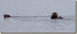
After the tour, we returned to the boats, had lunch and continued down El Capitan Passage into Sea Otter Sound. We have been seeing sea otters regularly in the cruising areas near the outer coast and Sea Otter Sound was no exception.

Today’s mileage – 23.4

Cumulative mileage – 2284.3

Current position

Wednesday, August 25, 2010

August 25 – Dry Pass Lagoon

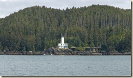
2010-08-403x The weather was excellent for rounding Cape Decision. While we lowered our stabilizer poles just in case we needed to drop the “stabi’s” in the water, we never needed to. The photo at right is the Cape Decision light house.

2010-08-25 Dry Pass Route After rounding the cape, we headed back up Sumner Strait, entered up towards Shakan Bay then worked our way to Dry Pass.

Dry Pass is a natural channel between Prince of Wales Island and Kosciusko Island that is dredged periodically to keep it navigable. There are navigation markers along the way and you don’t want to get confused as to which side to be on. Between navigation markers and GPS connected electronic charts though, it isn’t difficult but simply requires paying attention.

On anchorage for the night was at a lagoon in the channel between two narrower sections. Fortunately, there wasn’t a lot of other boat traffic so it wasn’t quite like camping in the median of the interstate.

Today’s mileage – 52.4

Cumulative mileage – 2260.9

Current position

Tuesday, August 24, 2010

August 24 – Port Malmesbury

We continue our path down Chatham Strait with the intent of rounding around the bottom of Kuiu Island. Port Malmesbury is one of the last anchorages before Cape Decision at the bottom.

The weather was a bit foggy at the beginning of the day but fortunately, we didn’t have the boat traffic we did several weeks earlier in foggy conditions in Icy Strait. As the day wore on, the visibility improved but the number of commercial fishing vessels did as well.

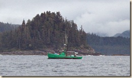
2010-08-384x Under the “rules of the road”, fishing vessels in the process of fishing have the right of way so we had to occasionally alter our course to stay out of their way. Fortunately, the vessels were all trollers so we did not have nets trailing behind the boat to worry about. The vessel in the photo at right was painted a very distinctive color which I had to document.

The particular anchorage we were in is called the “Mud Hole”. Despite the name, it is a very attractive spot. The name must refer to the remarkably level bottom in which we anchored.

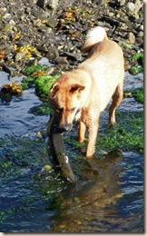
We were there early enough to drop the kayaks and paddle around. At one end of the bay was a stream with spawning salmon, both humpy and silver. The Nagle’s dog, Rusty, had a field day chasing after and catching the wriggling salmon. He did not eat any but simply enjoyed the chase.

2010-08-24 Route Today’s mileage – 44.6

Cumulative mileage – 2208.5

Current position

Monday, August 23, 2010

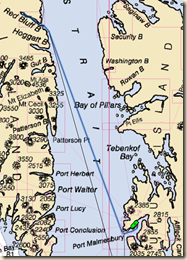
August 22-23 – Red Bluff Bay

After our relaxing time at Warm Springs, we headed a short distance further south to Red Bluff Bay. Both guidebooks and firsthand accounts rave about how scenic Red Bluff is so we are looking forward to it. Besides the scenery, the guides also talk about good prawn fishing, so we are anxious to try our hand at that, as well.

The weather forecast is such that we anticipate two nights on account of a brief storm and high winds rolling through. With a little patience, we are able to anchor in a very protected cove within the bay so we are well set up for winds.

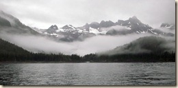
The bay is very scenic with snow capped mountains beyond the head of the bay. We repeatedly watch a brown bear prowling and fishing at the stream inlet.

We are sure the bear’s fishing was more successful than ours as we were skunked both for prawns and crabs.

Today’s mileage – 21.0

Cumulative mileage – 2163.9

Current position

Saturday, August 21, 2010

August 21 – Warm Springs Bay

The run to Warm Springs Bay was comfortable in calm seas. On account of the name, it is no surprise that the attraction here are the natural hot springs. There is as small community of vacation homes and a state public dock, which is generally occupied.

When we arrived, Mac from the DavidEllis went ashore in the dinghy and sized up the available spot. It was tight but Dave Nagle expertly put in his boat in it despite the strong current coming from a nearby stream. I then brought Alpenglow alongside to side tie to it.

We arrived with ample time to walk the quarter mile up the board walk trail to the hot springs sitting above the rushing stream (river?). The water temperatures were warm and very relaxing. The photo, right, is of Mac and Marcia in the pool.

Mac has been a guest of the Nagles since the middle of June. He is a retired police officer from Australia. Besides sharing the same occupation as Dave Nagle, he is also a dive instructor like Dave.

The photo below is a panorama of the bay, dock, stream inlet and some of the homes at Warm Springs Bay.

2010-08-365_stitchx


Today’s mileage – 39.4

Cumulative mileage – 2142.9

Current position

Friday, August 20, 2010

August 20 – Appleton Cove

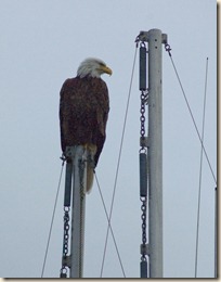
2010-08-358x We departed Sitka about 10 AM in order to time a slack current transit of Sergius Narrows, the protected water route from Sitka to Chatham Strait. A local eagle sat on the stabilizer poles of a nearby fishing boat and watched us depart.

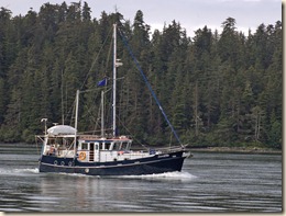
Along the way, we took a scenic detour through Nakwasina Sound and Passage. Wade, a guest of the Nagles on board the DavidEllis (image below), has lived several summers in Sitka piloting tour boats for cruise ship passengers and guided us through this section.

2010-08-360x We hit Sergius Narrows within 10 minutes of slack so its transit was not a problem. As with all choke points like this, it can get busy with other boats making their passage as well.

Our anchorage tonight was Appleton Cove. It is well protected from wind and waves and our one night here was calm and pleasant. We saw many crab floats out but because we were here only one night, we chose not to put out our crab pot.

2010-08-20 Appleton Cove Route Today’s mileage – 54.5

Cumulative mileage – 2103.5

Current position

Monday, August 16, 2010

August 14-16 Touring Sitka

We got back this afternoon from doing a short two night cruise to some local anchorages. Our “guide” has been Wade, a friend of the Nagles who is joining them for the return trip to Seattle. Wade is a retired United Airlines 747 pilot who, post retirement, worked summers in Sitka piloting tour boats for several seasons.

2010-08-14 Samsing Cove On Saturday, 8/14, we travelled only a short distance to Samsing Cove, a lovely anchorage only 4 or 5 miles from Sitka. Getting in was a bit of a challenge as one of the fishing seasons was open and commercial fishing boats nearly had the route into Samsing blocked by gill nets. We followed the DavidEllis in as they wound their way through boats and nets. After making our way in, we rafted up to the now anchored DavidEllis.

From here we dinghied around to Pirate’s Cove, a quarter mile west. A lovely, white sand beach invited us to spend a sunny afternoon relaxing.
2010-08-296x The next day, 8/15, after again transiting through active fishing, we headed towards St Lazaria Island. When Marcia and I visited Sitka in 2006 we did a tour to the island (perhaps even piloted by Wade?). The island is noted for its bird population, especially tufted puffins.
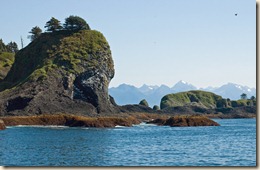
2010-08-305x The rocky cliffs are preferred by nesting birds as predators cannot easily reach them. You spot the bird nesting areas by looking for the white color of the dried excrement from the birds.
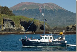
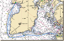
2010-08-318x As we were leaving St. Lazaria Island, I snapped the photo left of the DavidEllis with the island in the foreground and Mount Edgecumbe, the extinct volcano on the north entrance of Sitka Sound, in the background. The skies were blue skies, the winds light and ocean swells modest as we rounded Cape Edgecumbe and headed north to Goleta Cove. It too has a lovely sandy beach on which we relaxed in the afternoon sun.

Below is a stitched photo (six photos combined into one) taken from the boats stern looking south towards the north side of Mt. Edgecumbe.

2010-08-343_stitchX

2010-08-15 Goleta Cove Along the route, we passed a milestone for us by having travelled more than 2000 miles since we left Seattle in the middle of May.

This morning, 8/16, the weather clearly had begun to change, so we pulled anchor and retraced our route to Sitka. We arrived back in Eliason Harbor on the north end of town shortly before 3 PM.
Thursday, August 12, 2010

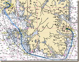
August 9 – 12 – Elfin Cove to Sitka

We departed Elfin Cove Monday, August 9, for Sitka. We started the trip by going to Pelican, another board walk community similar to Elfin Cove with no roads, only a board walk. The cannery in Pelican closed a few years ago and many other businesses in the community have not been able to make a go of it. Elfin Cove seems to be sustaining itself on its sport fishing lodges and commercial fisherman. Pelican has commercial fishing but it is further from the sport fishing area and doesn’t have as many lodges.
Travelling with the Nagles in the DavidEllis is their friend Shirley, the owner of the Elfin Cove bar damaged by fire earlier in the summer. She lives in Sitka for about half the year and was hitching a ride with them. Since she needs to be in Sitka by Wednesday, the Nagles have elected to travel to Sitka on the outside coast, the short route but more exposed to wind and seas. We don’t have that constraint and elect to go the long way back through Icy Strait, down Chatham Strait and then through Peril Strait (despite its name, the only perilous part is Sergius Narrows which requires timing in order to hit slack current).

Bright and early on Tuesday, we head north from Pelican and retrace our route from the previous day. Just north of Elfin Cove as we are motoring through the fog, we see three humpback whales heading towards us a few hundred yards away. We put the boat in neutral and begin to coast. The whales continue towards us, their backs rising and falling as they swim. About 50 yards away, the two whales still heading directly towards us, make the classic big arch of their back, flip their tail skyward and plunge dive. Of course we have no photos because we were so astonished we didn’t think of it until after the whales dove. The camera came out at the ready but no more whales made a grand exit in front of us.

Besides the whale encounter, the trip to Sitka involved one very long day (86 miles on 8/10), one not so long day (62 miles on 8/11), and one short day (30 miles on 8/12). The two anchorages we used, Pavlof Harbor on 8/10 and Deep Harbor on 8/11 were pleasant. The transit of Sergius Narrows was pretty straightforward as we hit it at slack current (it can run at over 7 knots at max current) with no opposing vessels to worry about. The weather by the time we got to Sitka was spectacular.

2010-08-265x Sitka is located on the outer coast but behind many protective islands. There are high mountains on one side and water on the other (of course, that describes nearly every Alaskan town in the Southeast). I think Sitka’s proximity to the ocean and the low profile of the islands to its west make it seem even more open and vast the other communities we have visited. In any event, it is a stunning setting and a lovely town (the good weather may be biasing my point of view, however).

Sunday, August 8, 2010

August 5 – 8 – Elfin Cove

After three glorious days in Glacier Bay, the clouds returned and the morning fog did not burn off. We motored south out of Glacier Bay into Icy Strait.

The visibility was less than 1/2 mile so we relied on our radar to tell us what vessels were out there. We usually run with our chart plotter displaying a split screen, the electronic chart on the left and the radar image on the right.  Things that aren’t charted, such as other boats, stand out that way.  Whenever you have a solid return on your radar image, you make a point of identifying whether it is a charted rock or buoy, everything left over becomes a “target” that you monitor.

The route to Elfin Cove goes through South Passage, on the south side of Lemesurier Island, and then through South Inian Pass. The currents can run pretty briskly through those passes so you want to time them towards slack current. Especially in South Inian Pass, if a strong ebb current collides with the incoming swells from the ocean, waves can stack up uncomfortably. We timed the current pretty well and had no problems.

2010-08-233x Elfin Cove is a small Alaskan fishing community built around two coves. The outer cove has a 200 foot community dock and we were able to get a spot. The inner cove is extraordinarily protected and calm but it is narrow and shallow and generally only used by the locals. We were fortunate to get dock space because both commercial and sport fishing boats use the dock for night time moorage. As it is a public dock, allowing boats to raft to you is expected if you are directly on the dock. Later we moved off the dock and rafted to the Nagles’ boat, the DavidEllis

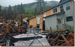
2010-08-238x Our friends, the Nagles in their boat the DavidEllis, had been in Elfin Cove since Monday, August 2, helping their friend Shirley Perkins who owns the Coho Bar & Grill there. About six weeks earlier a fire broke out at 2 AM in an adjoining building to the bar (KCAW radio news story). It took everyone in Elfin Cove and fire crews from several nearby communities to put it out. Shirley’s building was partially burned and received major smoke damage. The water used to extinguish the fire was salt water pumped from the cove so it contributed to the post fire damage.

Shirley had been busy cleaning and rebuilding (note the new siding). The Nagles volunteered their labor towards the effort while in Elfin Cove. While we stayed there, we added a couple of days of our labor as well.

2010-08-241x Elfin Cove has no road but is built along and around the boardwalk connecting buildings and homes. As the photo to the left shows, had the wind been blowing that night, it would have spread quickly from structure to structure and burned far more than it did.

We did take one afternoon off from work and took our boat with everyone else aboard over to a nearby island. It is the site of a artillery piece installed during World War II to protect the entrance to Icy Strait. It must have been an incredible effort to bring in everything needed to build and operate such a base.

Thursday, August 5, 2010

August 1 – 5 – Glacier Bay

To say we had a wonderful time in Glacier Bay is an understatement.  Bookend between a bit of clouds and wind at the start of the trip and mist and fog and the end of the trip were three absolutely gorgeous days.

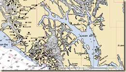
Glacier Bay NP Glacier Bay is quite deep, probably 50+ miles from the entrance to its head at the end of Tarr Inlet. We anchored in three different locations. North Finger Bay on August 1, Reid Inlet on August 2 and North Sandy Cove on August 3 and 4.

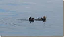
In the lower part of Glacier Bay we saw lots of sea otters.  They look just like the adorable videos on TV and the ones in the aquariums.  You see them floating out in the middle of the on their backs grooming their fur or eating the food they have gathered from the bottom.

Speaking of otter food, the locals talk about how the sea otters have put a significant dent in the crabbing in areas in which they are living. We can say from first hand experience that our crabbing attempts in Glacier Bay yielded absolutely nothing.

Rather than give a dull recounting of our day by day activities, I will let photos of the park speak for themselves.


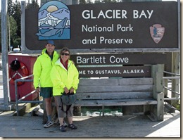
The day of our entry. We bought the “high-vis” rain jackets in Ketchikan when our “lower 48” rain gear proved inadequate for the Alaska climate.


2010-08-004x


2010-08-021x

The welcoming committee for Glacier Bay (yes, every bump is a sea otter).


2010-08-028x


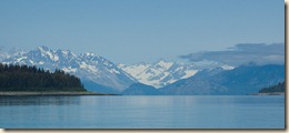
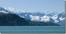
2010-08-052xThe views as you cruise north in Glacier Bay.


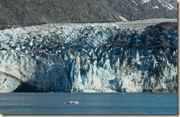
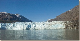
2010-08-088x 2010-08-118xWe were able to get very (1/2 mile) close to the glacier terminus of several tide water glaciers. Below is a stitched image of eight photos taken of the glacier terminus.

2010-08-120-127_stitchX


2010-08-103x

 2010-08-229x

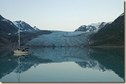
The anchorage in the photo to the left, Reid Inlet, was simply stunning. The glacier at the end of the inlet does not extend to the water but nearly so. We felt like we were anchored in the mountains.


2010-08-195x

 2010-08-226xWhile cruising to our final anchorage in the park, North Sandy Cove (photo right, above), we had great whale encounter with a pod of five feeding humpback whales. We probably sat for fifteen minutes drifting with the engine off watching the whales dive repeatedly within a half-mile of the boat.