Wednesday, June 30, 2010

June 30 – Back in Ketchikan

Yesterday, was a very rainy day so we had little interest in sitting in a bobbing dinghy in wind driven rain. We did retrieve the crab pot and found two keepers among the five crabs in the pot. We also tried our hand with the prawn trap but drew a blank.
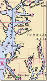
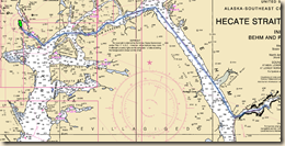
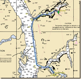
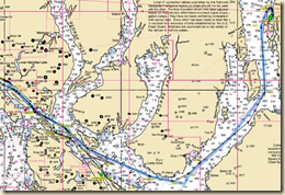
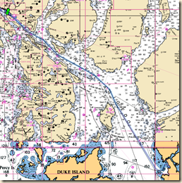
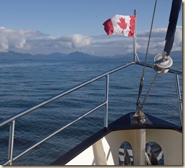
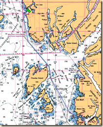
06-30 - Bar Harbor Route Since the winds are generally lighter in the morning, we left Yes Bay a little before 7 AM and headed south in Behm Canal towards Ketchikan. The trip was pretty calm until we reached the busy channel, Tongass Narrows, that passes in front of Ketchikan.

On account of the sport and commercial fishing, there is lots of boat traffic. The real twist on things are the many float planes taking off and landing. Between the scenic flights for tourism and the commercial flights taking passengers to outlying islands, it is pretty busy. It can be a bit disconcerting motoring along and have a float plane land 100 yards to one side or have a float plane pass a couple of hundred feet above your head after it has taken off behind you.
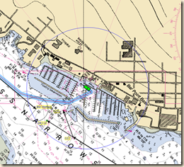
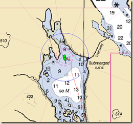
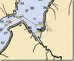
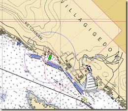
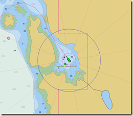
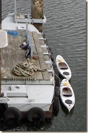
06-30 - Bar Harbor Moorage In order to be closer to boating services, we went to a different Ketchikan marina than we used before. Bar Harbor is the largest marina but can be totally full if the commercial fishing fleet is in town.

Fortunately, they had a space for us and we were tied to the dock shortly before 1 PM.

Today’s mileage – 41.0

Cumulative mileage – 955.6
Current position

Monday, June 28, 2010

June 28 – First Blood

Behm Canal on the west side of Revillagigedo Island offers excellent fishing. Guides leaving from Ketchikan work the lower portion and guests at the Yes Bay resort work the upper end. The thought of catching a king salmon or a halibut was a mighty temptation for Marcia and while in Ketchikan she outfitted herself with a license and the necessary equipment.

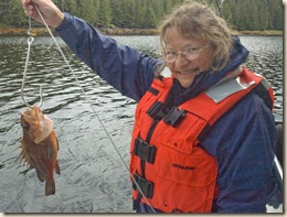
2010-06-196x On the morning bite, we took our dinghy and retraced our way back to the outer portion of the bay. Marcia had her salmon gear and dropped her line in about 180 feet of water. After about 10 minutes, she pulled her line up and had her first catch, a rock fish. Not exactly the 20 lb king Marcia had in mind but still, you have to start somewhere.  After a few more tries, it proved to be the only catch of the day. After we returned, the rock fish was featured in our lunch its head and other parts became bait for the crab pot which we took out after lunch.

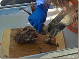
2010-06-204x In the afternoon, after a 4 hour soak, we pulled the crab pot up and found a nice 7 inch keeper dungeness crab and one smaller female crab which we returned. Lots of bait left so back the pot went to see what an overnight soak will produce. For us, though, it is crab for dinner tonight.

Sunday, June 27, 2010

June 27 – Yes Bay

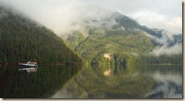
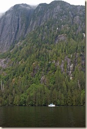
2010-06-191x We awoke in Walker Cove to broken clouds. It provided some wonderful light for a photograph of a boat with whom we shared the cove. This same boat was in Punchbowl Cove with us as well. Since anchoring is difficult in Walker Cove, we offered to have them raft with us on the mooring buoy but they declined and managed to find a good hook with their anchor.

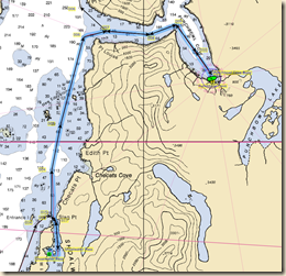
06-27 - Yes Bay Route From here, we motored around the north end of Revillagigedo Island through Behm Narrows. Our destination was Yes Bay on the northwest side of Behm Canal and only about 40 miles from Ketchikan.

06-27 - Yes Bay Anchorage We negotiated our way through a couple of narrow channels, past the Yes Bay Resort and into the back end of the the inner bay. Since we started around 7 AM, we were anchored with the engine off shortly after 2 PM.

The early arrival gave us ample time to launch the dinghy for the first time on the trip. Since we left Seattle the middle of May, whenever we’ve felt the need to leave the boat while at anchor, we’ve used the kayaks. The launch was uneventful and the Honda outboard started up after a couple of tugs despite it having not been run for three months since our shakedown trip the end of March.

Today’s mileage – 49.5

Total mileage – 914.6

Current position

Saturday, June 26, 2010

June 26 – Walker Cove

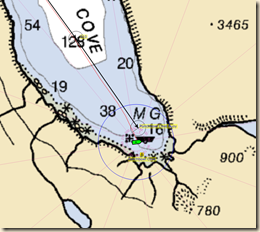
06-26 - Walker Cove Route We continued our short hops up Behm Canal in Misty Fiords National Monument while staying at US Forest Service buoys. Today’s destination was Walker Cove, one fiord north of the Rudyerd Bay/Punchbowl Cove.

Anchoring within the fiords is difficult because the sides are very steep. About the only places where depths are convenient for anchoring (30 to 80 feet) are near the outlets of streams. Unfortunately those areas are often too shallow, drying at low tide, and then dropping quickly to depths too deep.

06-26 - Walker Cove Moorage Before we left Ketchikan, we stopped by the USFS office and got information on the buoys. The person with whom we spoke said the buoys had all been replaced last year and would be ample for a boat our size.  We do set our anchor watch alarm to warn us in case the buoy lets us drift too far.

Our buoy snagging technique must be improving as we got the Walker Cove buoy on our first attempt. We were engine off and moored before 11 AM.

DSC_7759x Shortly after we arrive, the rain begins to fall.  The kayaks stay in their cradle on top of the boat.  Marcia takes this time as an opportunity to get her fishing gear ready for later use.  Low tide is in the evening and we see a grizzly bear come down to the sedge grass growing along the shore to graze.

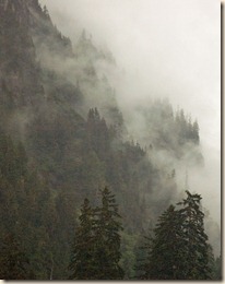
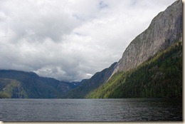
Walker Cove is a stunning setting equal to that of Punchbowl Cove. As we watch the low level clouds drift through the trees on the slopes and pour over the ridges we have a clear understanding why the area is called Misty Fiords. The area is a real treasure.

Today’s mileage – 19.0

Current mileage – 865.1

Current position

Friday, June 25, 2010

June 25 – Punchbowl Cove

06-25 - Punchbowl Cove Route Today turned out to be a very short day, a little over 10 miles with less than 2 hours of engine time.

Punchbowl Cove/Rudyerd Bay is one of the signature sites within Misty Fiords National Monument. It is a winding inlet surrounded by rocky mountain sides. We visited here in 2001 on an Alaskan state ferry in the pouring rain and waterfalls were cascading down the cliffs.

The weather today was considerably better than on our 2001 trip but it was still overcast. It was better, though, than we have had since the sunny weather that greeted our Ketchikan arrival.

06-25 - Punchbowl Cove Moorage Our plan was to check out Punchbowl Cove where a US Forest Service buoy is located and, if available, grab it. If taken, we would continue another 20 miles north to Walker Cove, another USFS buoy site. Fortunately for us, the buoy was available and after 3 attempts (the first two were too fast or off the mark slightly), we snagged the buoy and were tied securely.

The advantage of buoys is that you don’t have to worry about the anchor dragging or retrieving 300 feet of chain between you and the anchor. When leaving the next morning, untie one end of the line from the cleat on your boat and pull the line through the ring from the other end. In about 20 seconds you are free and clear.

On account of the area’s notoriety, a steady stream of scenic flights from Ketchikan are coming through. They will dwindle off as the cruise ships get ready to depart from Ketchikan and the airplane’s customers all embark for their next port of call.

DSC_7751x

Today’s mileage – 10.3DSC_7748x

Cumulative mileage – 846.1

Current position

Thursday, June 24, 2010

June 24 – Winstanley Island

We ordered a number of things to be sent to us general delivery, Ketchikan so while they are in transit, we have taken off for a trip around  Revillagigedo Island. This is the island on which Ketchikan resides.  The trip will also go through Misty Fiords National Monument.

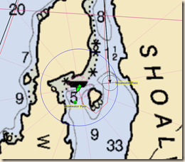
06-24 - Shoalwater Route Today’s trip was southbound out of Ketchikan, retracing some of the route we took getting here.  After about 20 miles we turned left and head up Behm Canal into Misty Fiords. 

Shortly after we left the harbor, we were dodging a few small logs in the water.  Ahead, 100 yards or so, I saw a somewhat larger log.  The “log” proceeded to spout a few times and do a shallow dive.  Needless to say, it was a humpback whale and not a log.  Before we could reach our camera though, it arched steeply and did a deep dive. No picture this time.

06-24 - Shoalwater Buoy Our destination today was Winstanley Island, on the south shore of Behm Canal. There is a US Forest Service buoy in the bay available on a first come – first served basis.  If the buoy was taken, there is also good anchorage.

Fortunately, the buoy was available.  After two attempts, we snagged and tied off the buoy to our forward bollards. We have used Washington State Parks buoys in our previous boat but this is the first time in Alpenglow. Since this boat is higher off the water and the buoy we are snagging is a lot beefier, we had to use a different technique.  We will refine it as we try other buoys in the days ahead.

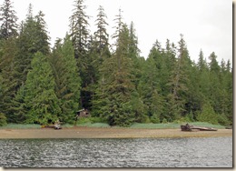
Besides the buoy, the Forest Service has a cabin on shore, popular with kayakers, for rent.  Shortly after we arrived, a boat shuttle picked up two kayakers staying at the cabin and replaced them with a solo kayaker.

Today’s mileage – 43.4

Cumulative mileage – 835.8

Current position

Tuesday, June 22, 2010

Laser Eyes

Dinner for the “girls” is precisely 4 PM. Today we were running errands in town and returned a little after the expected time. Annie & Maggie were waiting for us and our explanation. We are glad their eyes are merely reflecting the camera flash and not emitting laser beams.

Sunday, June 20, 2010

Beating to the pulse of cruise ships

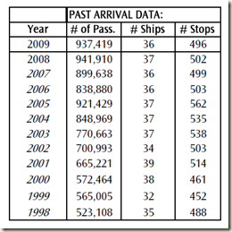
In recent years, Ketchikan has been shifting much of its economy from imageextractive industries such as logging to tourism. For 2010, they are forecasting 429 stops by cruise ships with an estimated 771,000 passengers aboard. As you can see from the table to the right, though, that is down nearly 20% from recent years.

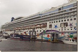
Where we are moored at the city floats, we can watch ships come and go from two of the four cruise ship berths. The typical pattern is a 7 AM arrival, passenger disembarkation at about 8 AM, and a departure between 3 PM and 5 PM.  Last Friday, we saw five cruise ships pass through town. The next day, only one.

Activity in downtown moves with the pace of the cruise ships. It awakens with the first passengers and falls back to sleep as the cruise ships depart.

At the docks, tour boats and fishing guides race in to pick up clients and then return them 3 or 4 hours later.

 2010-06-140x

Friday, June 18, 2010

June 18 – Ketchikan

06-18 - Ketichikan Route Weather and sea conditions remained favorable and the cruise into Ketchikan was good. The radio and boat traffic increased dramatically the closer we got to Ketchikan.

All of the marinas in Ketchikan are managed by the port authority and they may assign you to any of in the town depending on your requirements and their inventory. Many of the slips in the largest marina, Bar Harbor, are “hot” slips normally occupied by a fishing vessel but available when the vessel is gone.

We expect to be in and out of Ketchikan for about a month waiting for our friends the Nagles to make their way north. Based on that we are intending to buy a one month moorage pass and the harbor master suggested we go into the City Floats, tucked in behind the berth 3 for cruise liners. It is a bit intimidating crossing between two cruise ships to find you mooring site.

06-18 - Ketchikan Moorage We are moored at 11:15 AM and shortly after 12 PM we’ve been cleared by the Customs and Border Patrol agent who visited our boat (Ketchikan is a 100% inspection entry point).

Today’s mileage – 36.6

Cumulative mileage – 792.4

Current position

Thursday, June 17, 2010

June 17 – Welcome to Alaska – Foggy Bay

2010-06-120x It pays to be patient some times and this was the case today. The skies were clear and the winds mild as we crossed Portland Channel into Alaska.

The total distance from Prince Rupert to Ketchikan is a bit over 80 miles. The pattern is for the winds to pick up in the afternoon so ideally you are off the water around lunch time.

06-17 - Crossing into Alaska 2Being a slow boat, there is no way to reach Ketchikan in one day by early afternoon. The US Customs and Border Patrol, however, does give permission for boats to anchor in Foggy Bay before clearing. Marcia calls them and obtained the necessary permission.

06-17 - Foggy Bay Route We were joined in the anchorage by two Nordic Tug 42’s, Reflections and Abacus, traveling north at about the same pace as ourselves. 06-17 - Foggy Bay AnchorageWe’ve bumped into them several times.  While the inner cove’s entry is a little tight, especially at low tide, the anchorage is delightful.

We celebrated our first Alaska anchorage with sparkling wine given to us before our departure by our friends the Crowders.  All in all, a  wonderful introduction to Alaska cruising. Oh that every day would be like today.2010-06-129xToday’s mileage – 49.1

Cumulative mileage -  755.8

Current position

Wednesday, June 16, 2010

June 16 – Killing Time

We are still anchored in Pillsbury Cove across from Prince Rupert. We don’t really need anything in town so pulling the anchor and trying to dock in tight quarters in winds (it blows 10 – 20 knots out of the west in the afternoon) is not appealing.

There is an island with a dock a short distance (1/4 mile) away so we drop the kayaks and paddle over. We think it may be some sort of park but we don’t see any signs. Nobody around to ask, though.

Monday, June 14, 2010

June 14 – Prince Rupert

It rained heavily overnight in Coghlan Anchorage but the winds let up by morning. Anchor pulling went fine. The bottom must be sandy because there was no mud on the chain or anchor despite it having dug in deeply on account of the wind.

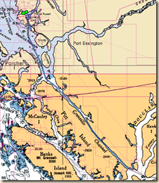
Two miles later, we are motoring up Grenville Channel, an equally narrow (yet deep) channel as Princess Royal Channel. The channels are generally less than a mile wide yet nearly a 1,000 feet deep. The peaks on either side are several thousand feet high. You can almost visualize the glaciers gouging these channels out during the ice age.

Besides small craft like ourselves and fishing boats, commercial traffic such as tugs with barges and passenger vessels use Grenville Channel. No cruise ships today but we did pass going south bound the B.C. ferry that goes from Port Hardy on the north end of Vancouver Island and Prince Rupert, the last major community on the British Columbia Pacific coast.

06-14 - Pillsbury Cove Route Based on the weather forecast, we did a long day and made Prince Rupert our today’s destination. As we got within cell phone coverage, Marcia started calling the various marinas.

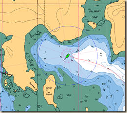
We knew that Prince Rupert pleasure craft moorage is tight during the summer. It proved to be so last night so we motored across to a cove on the north side of Prince Rupert Harbor, Pillsbury Cove, and dropped our anchor for the night.

06-14 - Pillsbury Cove Anchorage During the day, as we motored north, the weather continually improved. We were in full sun when the anchor was snubbed and the engine turned off. Our attitude was decidedly improved over 24 hours earlier when we were in strong wind and rain.

Today’s mileage – 76.9

Cumulative mileage – 706.7

Current position

Sunday, June 13, 2010

June 13 – Coghlan Anchorage

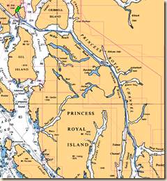
The winds let up overnight and we, along with three other boats, got a 7 AM start to hit the slack water at Hiekish Narrows. From there it is a long slog up Princess Royal Channel, the main route north. The channel is very protected and generally pretty calm.

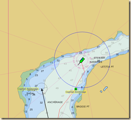
06-13 - Coghlan Route As we entered Wright Sound near Hartley Bay, southerly winds began to pick up to the upper teens and the rain began. Our destination for the night was Coghlan Anchorage, a somewhat protected channel between Promise Island and the mainland.

06-13 - Coghlan Anchorage We tucked as well as we could towards the north side of Promise Island, dropped our anchor and 240 feet of chain and watched it stretch out as we drifted back in the wind. Our anchor, a 120 pound (55kg) Rocna, is a beefy tool and it dug in well. With the wind staying strong, we stayed stretched out and hardly moved. While a bit noisy on account of wave chop, the anchorage turned out better than we were expecting in these conditions.

We were joined in the anchorage later by a Canadian Coast Guard vessel doing exercises in the area.

Today’s mileage – 57.9

Cumulative mileage – 629.8

Current Position

Saturday, June 12, 2010

June 12 – Waiting in Bottleneck

We passed our storm day in Bottleneck lazily. It was too rainy and windy to paddle in the kayaks so we were boat bound.

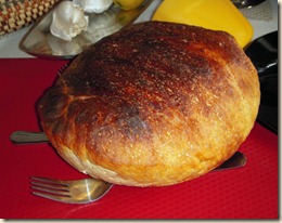
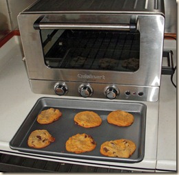
Anticipating this outcome, Marcia prepared bread dough the day before to bake in the toaster oven while the generator was recharging batteries today. We have a 9KW generator but the inverter/charger uses less than 2KW for charging.  Generators run most efficiently when loaded 60% – 80% of capacity so we added resistance loads like the toaster oven and an electric space heater to increase the load factor.

As usual, the bread Marcia prepared came out wonderfully crusty. She uses a “no-knead” recipe we got from the New York Times in 2006. Besides the bread, as an extra treat, Marcia made some chocolate chip cookies.

Friday, June 11, 2010

June 11 – Bottleneck Inlet

A front is forecast to cross over the area this evening bringing wind and rain. We’d rather not be stuck in Shearwater too many nights so we departed about 8 AM this morning.

Until the front passes though, wind and sea state are relatively benign so we took advantage of conditions and took the “express” route up Milbanke Sound rather than the more sheltered (but slower) route through Reid Passage and Percival Narrows.

06-11 - Bottleneck Route The direct route is also convenient for stopping at Klemtu to add some more water to our tanks. Shearwater has water available but, as is often the case with water along the Inside Passage, it has a slight tint on account of tannin from the trees in the water shed. Klemtu has a full up water treatment plant with good clear water at its fuel dock. A one hour stop allowed us to add an estimated 150 gallons to the 200 gallons remaining in our tanks. This ought to be enough to get us to Ketchikan.

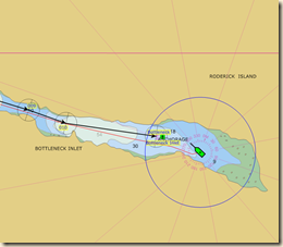
06-11 - Bottleneck Anchorage So far, we have repeated only two anchorages from our 2007 cruise, Waddington Bay and today’s stop, Bottleneck Inlet. It is a well protected stop with convenient anchoring depths (20 to 30 feet) and sufficient space for many boats swinging on safe anchoring scopes. We spent 3 nights here in 2007 with a half-dozen other boats waiting out a storm. We hope this year’s stop isn’t quite as long.

Today’s mileage – 46.2

Cumulative mileage – 571.9

Current Position

Thursday, June 10, 2010

June 10 - Shearwater

Shearwater and the nearby town of Bella Bella are the primary coastal communities between Port Hardy on Vancouver Island and Prince Rupert just short of Ketchikan. Bella Bella is the more populous but Shearwater is more tourist oriented.

Shearwater Route The trip up from Kisameet was short, a little over 20 miles. Boat traffic concentrates in the channel (Lama Passage) approaching the area, fishing boats, cruisers and ferries. Both the B.C. and Alaskan ferries pass right by. We turned off towards Shearwater just as the Columbia, the Alaskan ferry going between Ketchikan and Bellingham came through the northern pass approaching Bella Bella.

Shearwater Moorage We’ll be here just one night to do laundry and minor provisioning (we’re dangerously low of white wine!). Our plan is to head to Prince Rupert briskly and not poke around too much. We are taking the main route via Princess Royal Channel and Grenville Channel (aka “The Ditch”).

Today’s mileage – 20.5

Cumulative mileage – 525.7

Current Position

Wednesday, June 9, 2010

June 9 – Kisameet Bay

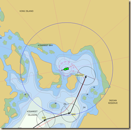
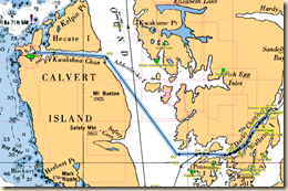
Kisameet Anchorage Today was a short cruising day, about 22 miles. Folks in a hurry would have gone to the community of Shearwater (our likely destination tomorrow) another 20 miles further but we are taking our time. The guide books speak highly of this anchorage so we thought we would check it out.

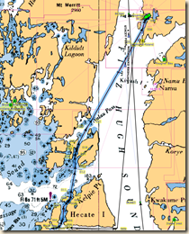
The route we followed today turned out to be a treat. We cut across Hakai Passage, a channel exposed to the full ocean swell. Islands and rocks on the outer coasts have a different appearance and vegetation than those in protected waters. It doesn’t take a lot of imagination to visualize how fierce winter storms batter the outer islands.

Kisameet Cruise Hakai Passage was pretty benign and the low swells we experienced disappeared totally as we started along Ward Channel, the narrow route connecting Hakai with Nalau Pass. From there we diagonalled across Fitz Hugh Sound to tonight’s anchorage.

As we entered Nalau Pass, we glimpsed the first whales of the cruise. At least two humpback whales were feeding in the area. The most you can see of the humpbacks are their tails sticking up as they start their dive. Hopefully these are the first of many whale encounters.

Today’s mileage – 21.9

Cumulative mileage – 505.2

Current position

Tuesday, June 8, 2010

June 8 – Hakai Beaches

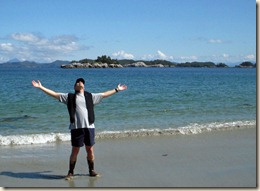
We took advantage of our flexible schedule by spending a day at anchor in the cove south of Pruth Bay. We enjoyed our walk to West Beach the day before so much we decided to do it again and extend it to North Beach.

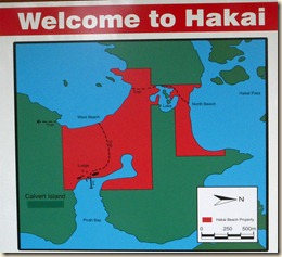
The red portion on the map to the left is owned by the Hakai Beach Institute. It is a private non-profit organization that operates a lodge open to educational groups doing biological research. Up until September 2009, the facility was a high end fishing lodge. They allow visiting boaters to use their dinghy docks to access the trail to the beach.

The weather today is quite lovely. As I am sure you can tell, the sunshine has improved our disposition significantly.

Monday, June 7, 2010

June 7 – Pruth Bay

It was a rainy start from Daswons Landing this morning but it soon let up and by the end of the day we had patches of blue. One blessing of the frequent rain we have had is that the boat deck is staying pretty clean and we have no salt crusting on the boat.

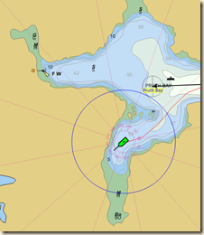
Pruth Bay Route Today’s route retraced our waypoints back along Darby Channel into Fitz Hugh Sound. After only a dozen miles, we hung a sharp left and headed almost due west in Kwakshua Channel to its head at Pruth Bay.

Immediately after we dropped our anchor, two Nordic Tug 42’s pulled in and dropped their’s. We aren’t anti-social but being by yourself in an anchorage (as we were at Allison Harbour), is a special treat. We had chosen the bay to the south of the main anchorage because the guides indicated it

Pruth Bay Anchorage Perhaps it was our negative vibes or perhaps it was their plan all along but after a lunch break the Nordic Tugs hoisted their anchors and headed out of the area totally. A delightful anchorage to ourselves.

After lunch, we dropped the kayaks in the water and paddled over to the west head of the bay. From there you walk a quarter mile or so to West Beach, a lovely sandy beach open to the ocean swells. I’ll do a bigger write-up of that activity with photos tomorrow.

Today’s mileage – 25.6
Cumulative mileage – 483.3

Current Position

Sunday, June 6, 2010

June 6 – Dawsons Landing

The report from the West Sea Otter met our standards (less than 1.5 meters of combined wind waves and swell) as did the lighthouse reports for Egg Island and Pine Island (rippled with a low westerly swell). We were away shortly after 6:30 AM.

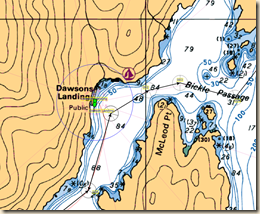
Dawson Landing Route The conditions were fine and we rounded Cape Caution a couple of hours after pulling the anchor. The further we went in Fitz Hugh Sound, the more benign became the sea state.  Things damped down even further in the protected Darby Channel on the north side of Penrose Island.

As of about 1:10 PM,Dawson Landing Mooragewe are tied to the dock at Dawsons Landing, a small general store/resort/community along Rivers Inlet. While here, we’ll add a few provisions (wine is getting low), use the Internet and other chores.

From here, we aren’t sure where exactly we will go. Based on guide books, there are some areas worth further investigating.

Today’s mileage – 46.9

Cumulative mileage – 457.7

Current Position